The enormous challenge of Choquequirao

(It is pronounced Choccie-ki-row where ‘row’ is having a fight, not being in a row boat. English has too many vowels and not enough precision with expressing them.)

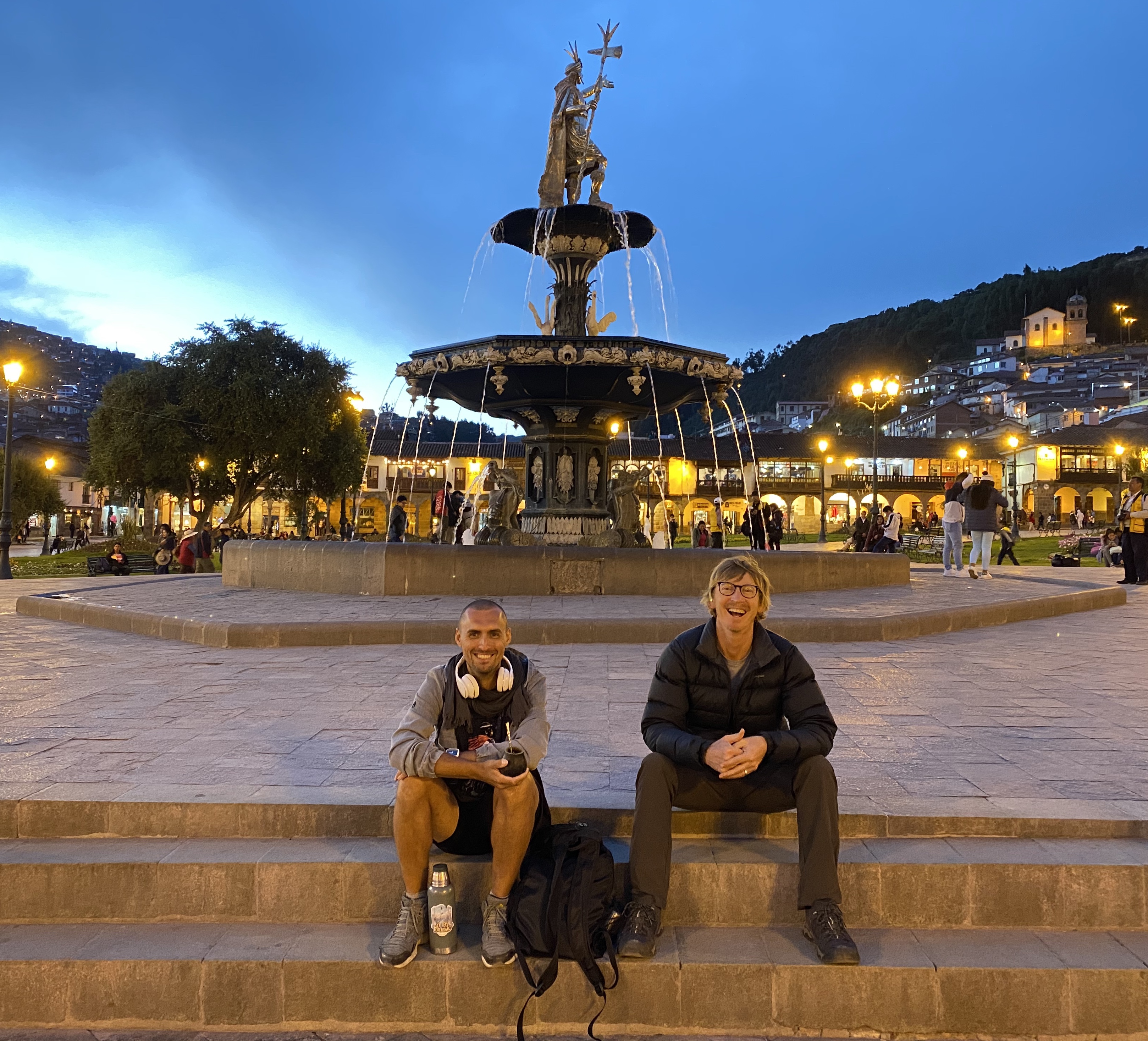
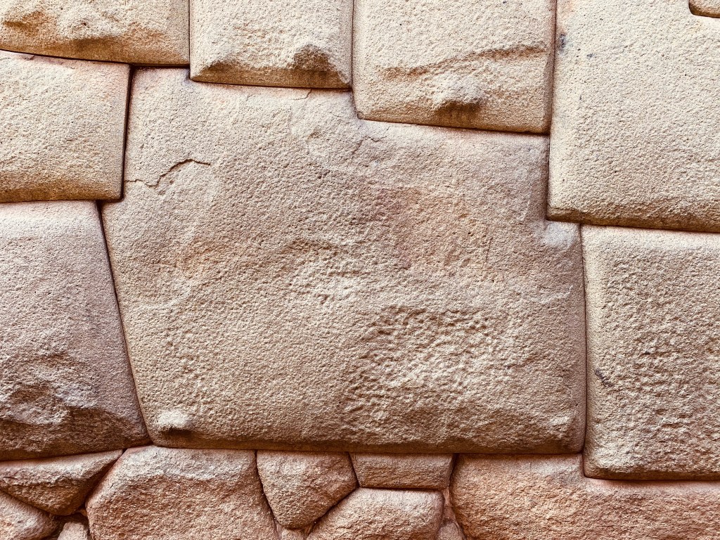
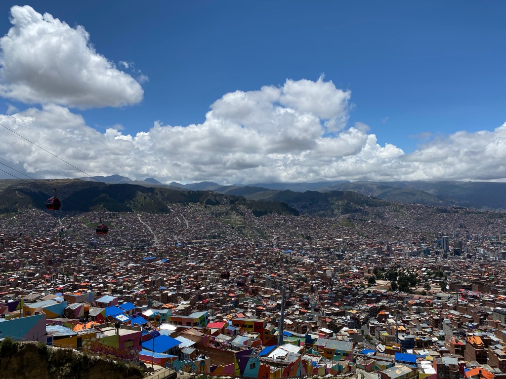
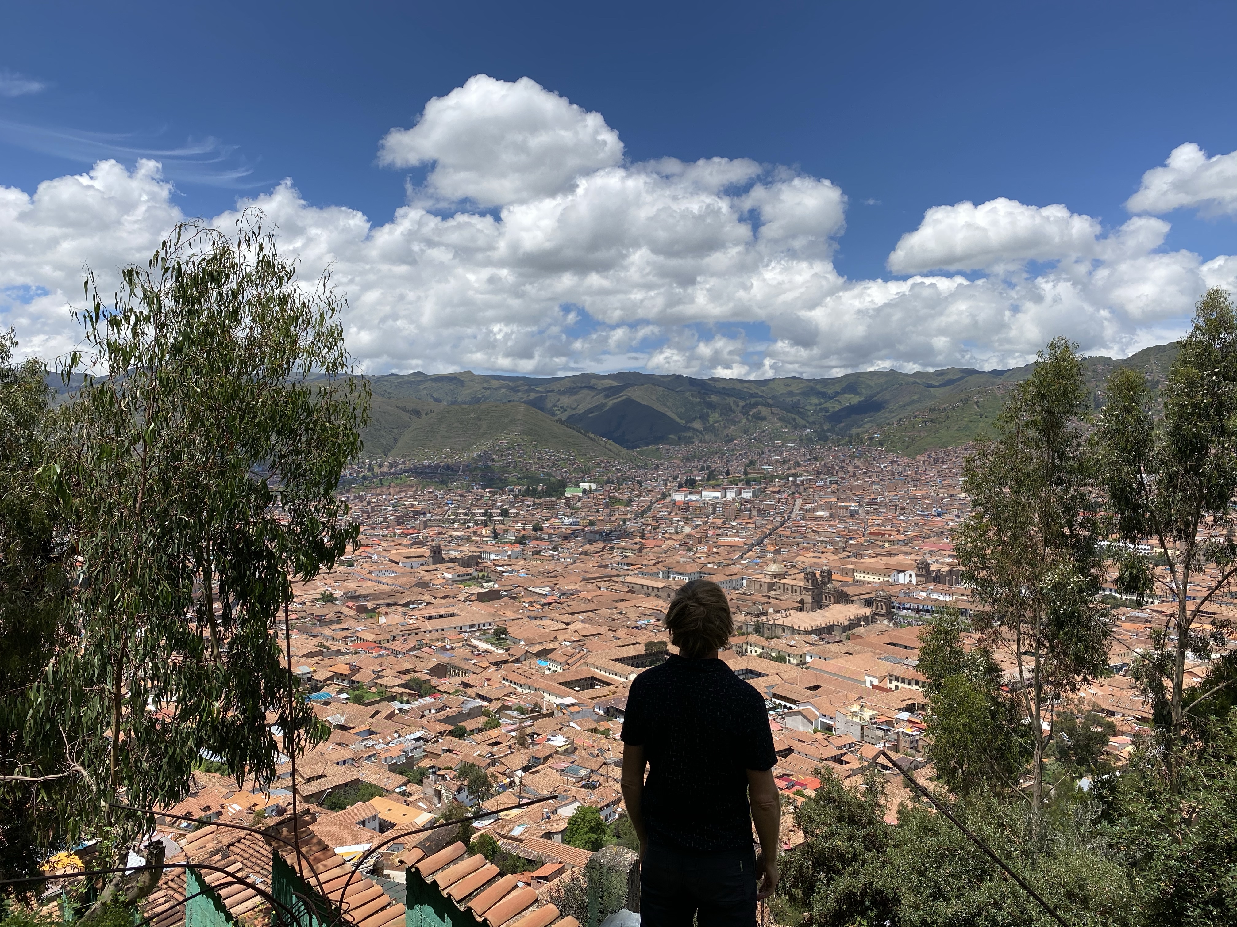
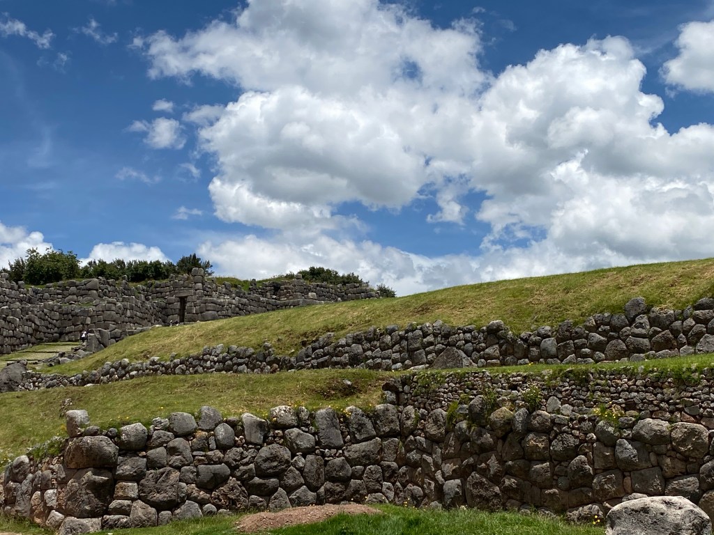
I am not one to let less-eventful days go uncelebrated so I will quickly celebrate last Sunday in Cusco before we started the hike on Monday. We adventurously traipsed the forest on the outskirts of San Blas to see how much of the high-up ruins of Sacsayhuamán we could enjoy without paying the exorbitant entrance fee. It turned out we could enjoy quite a bit, including some more incredible stonework. What’s left there isn’t much, as the Spanish dismantled a lot of the site to build Cusco.

We dined at our favourite place for a vege uplift – Green Falafel – and spent the afternoon preparing for the trek. On the morning before leaving, we stuck around until the next-door coffee shop opened, where we enjoyed a creamy brew (and, a decadent pastry. Treat yo’ self). I feel like we still haven’t let go of our Australian beliefs that a good coffee prepares you for anything.

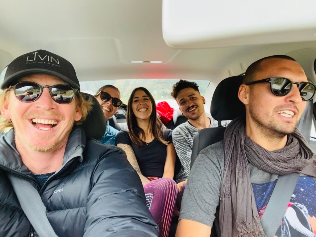
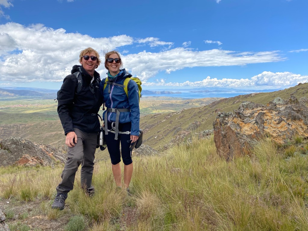
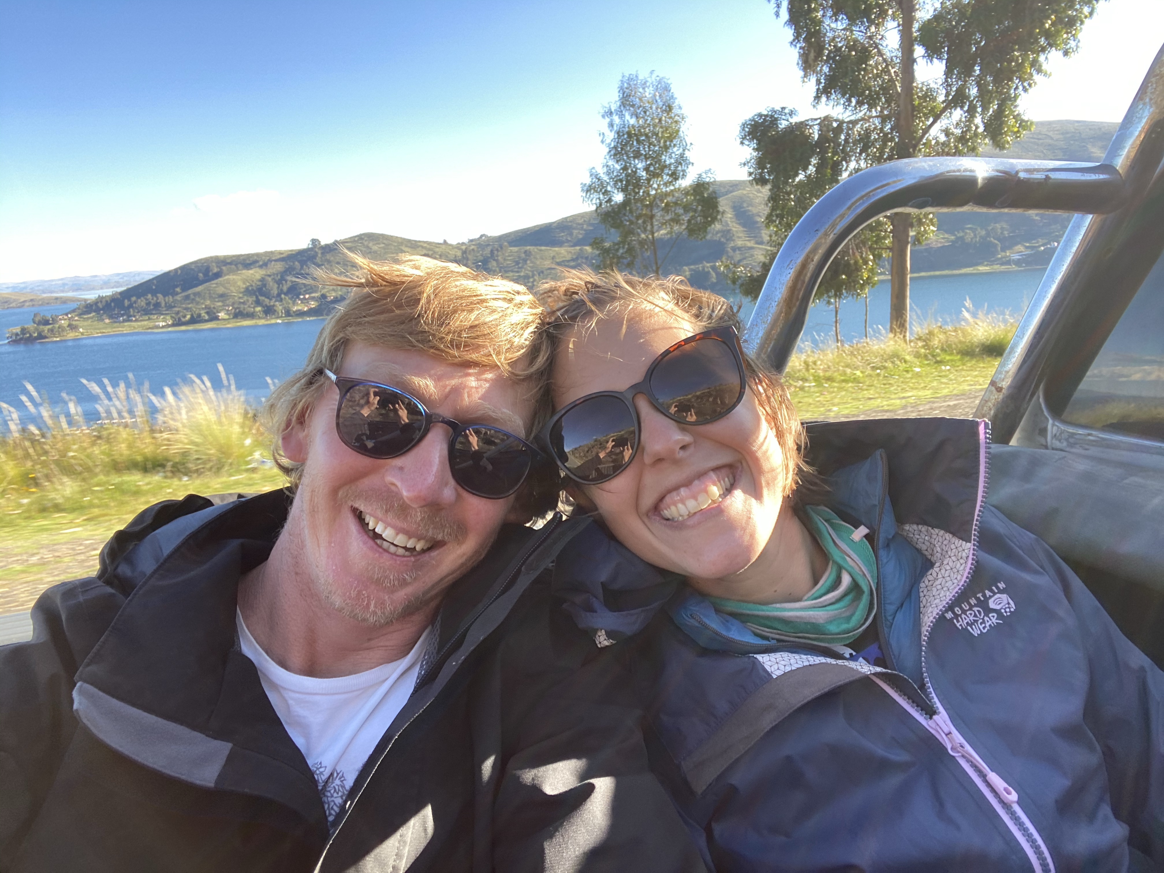
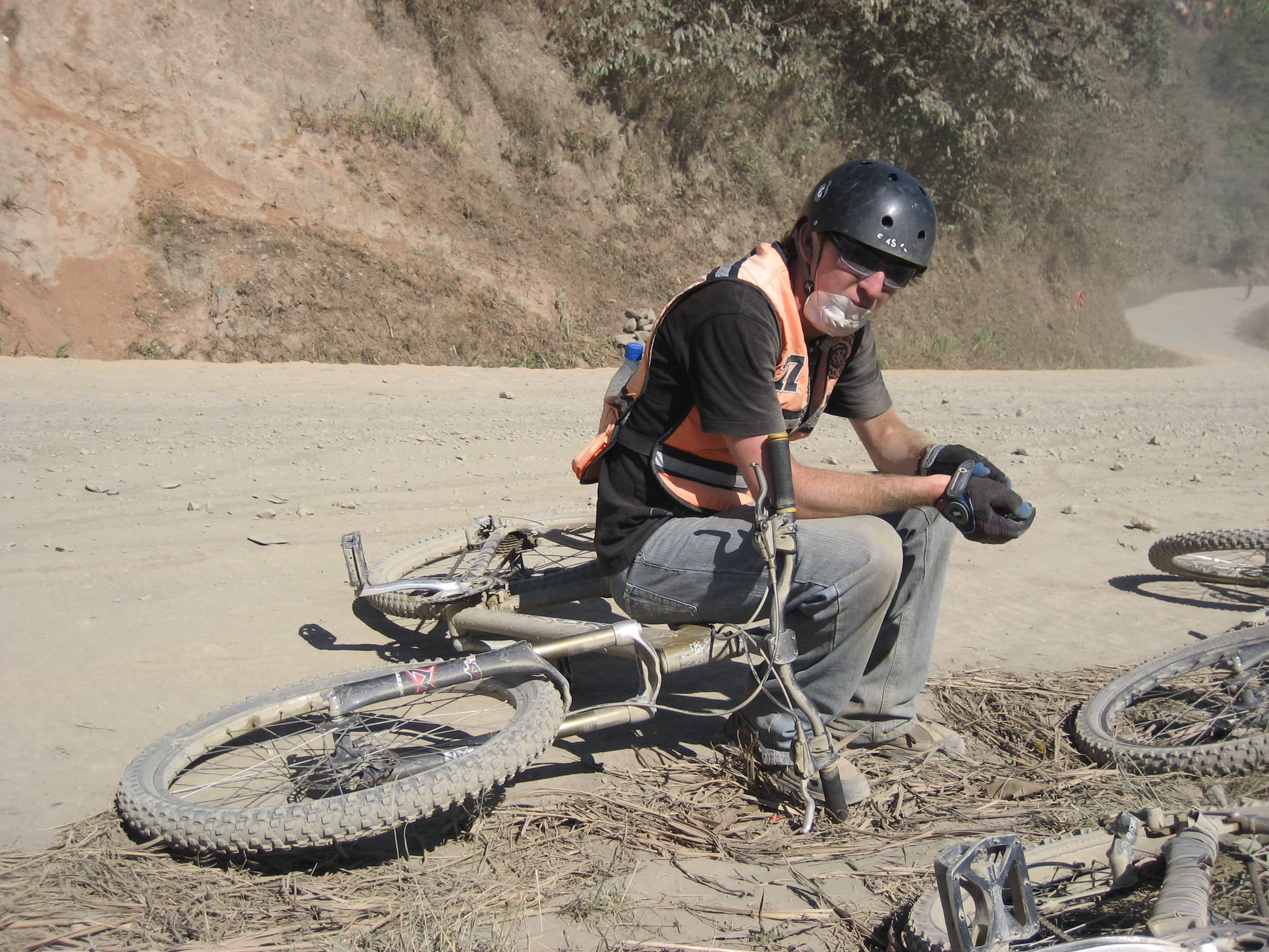
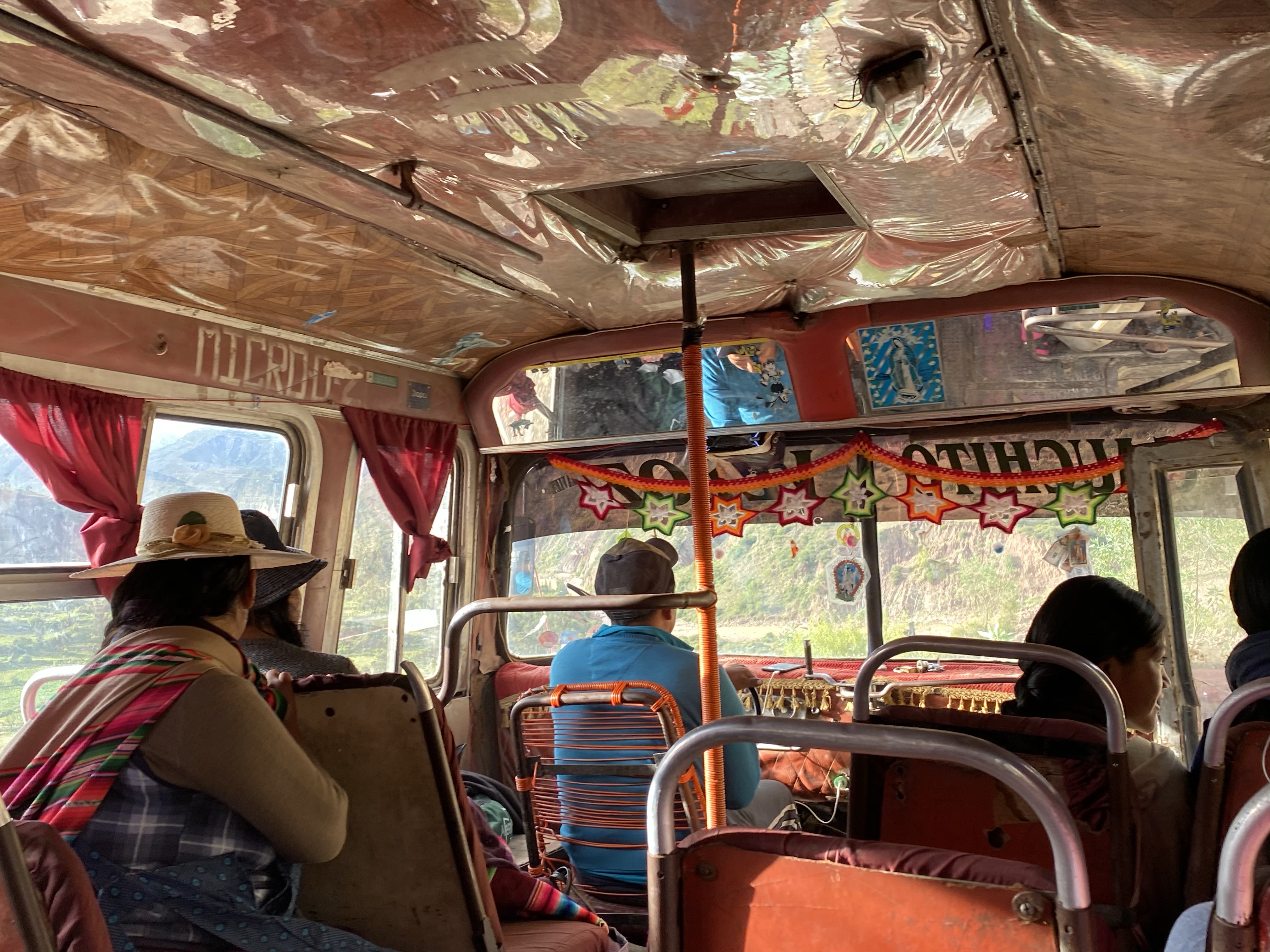
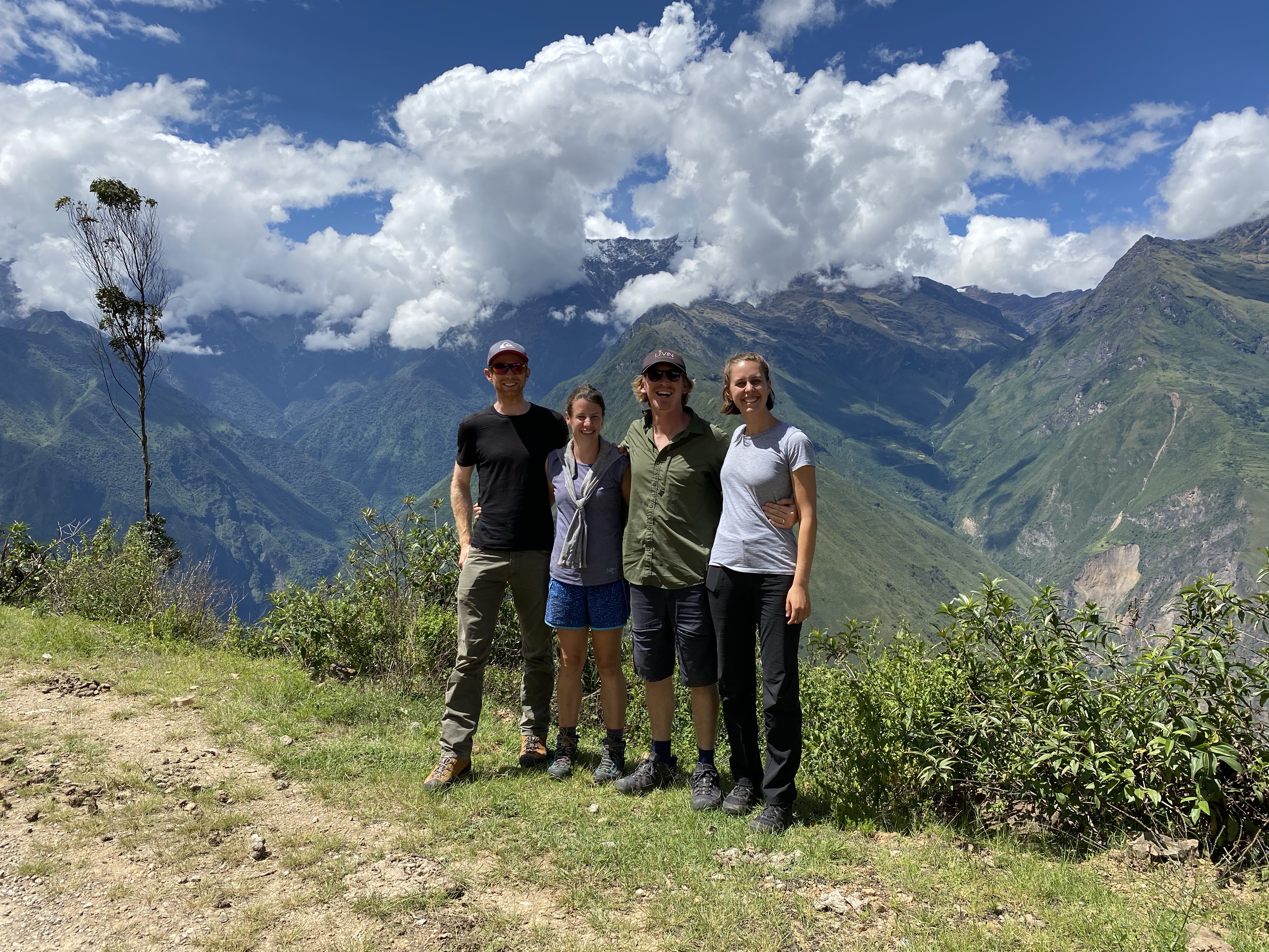
And so, caffeinated, packed, we first braved the four hours of transport to the trek’s starting point – Capuliyoc. Generally a taxi ride wouldn’t be much of a tale but this one is the exception. Firstly, because we had such excellent company as we were joined by now-friends Heather and Jack from England who were heading on the same trek. But second, because our taxi driver was a manic rally driver who’d failed to make it professionally and took out his disappointment on every one of the tiny, winding corners of the drive. The G-forces were incredible, and it was a gym workout and a half for me to grip to the headrest poles of the seats in front so as to try not to squish Heather beside me.

While we were making polite noises about slowing down, he only really took us seriously when the car in front (driving equally fast) suffered a serious one-car crash which everyone was very lucky to have survived. It shook us. We resolved to give drivers in the future minimum arrival times so they couldn’t try to go any quicker.

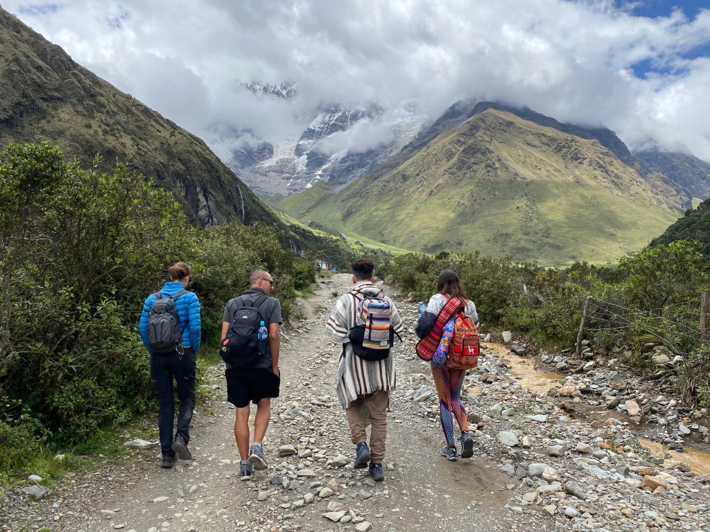
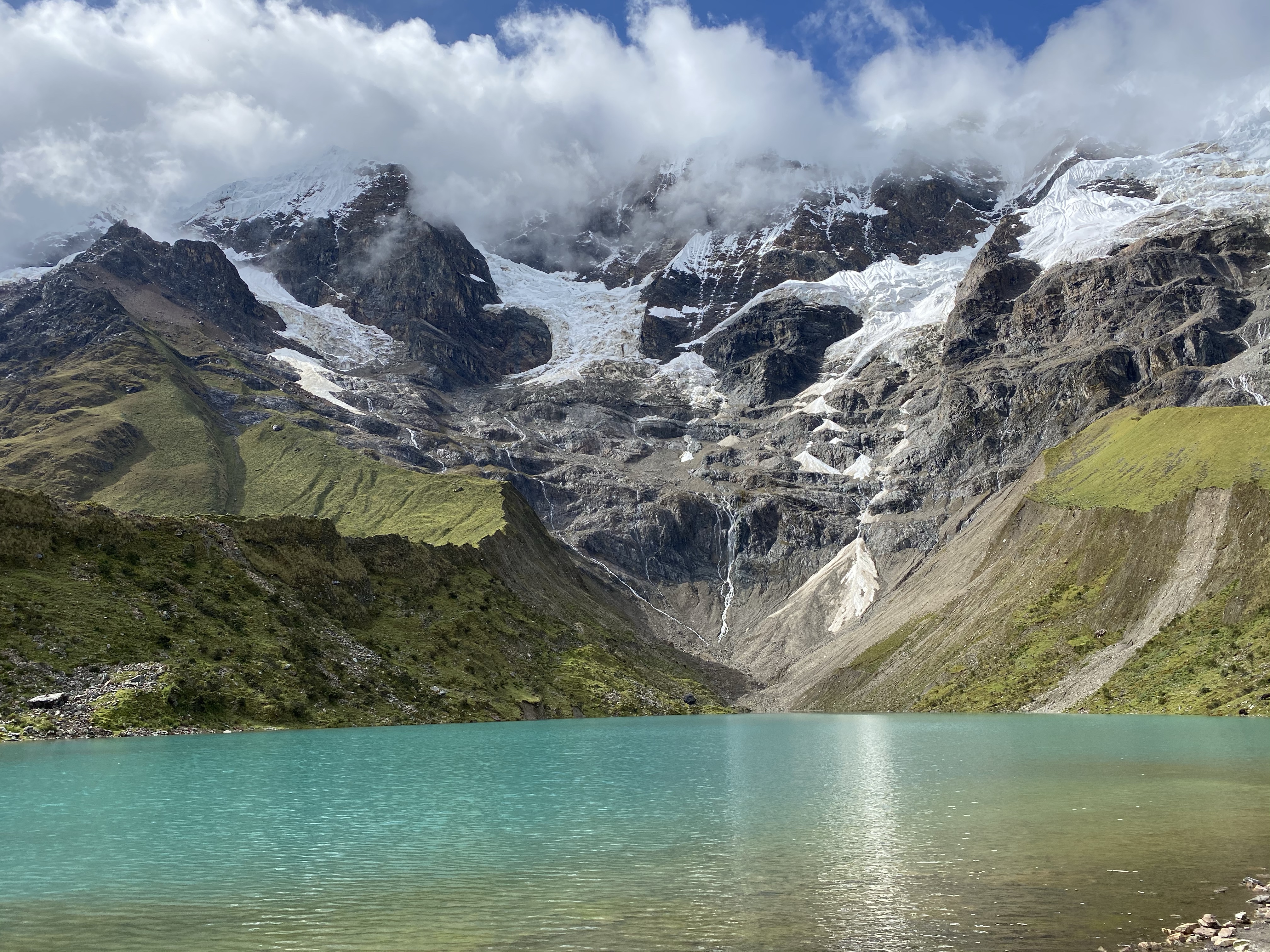
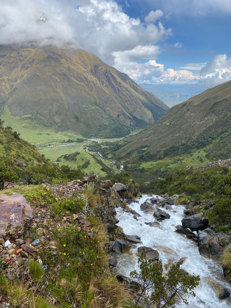
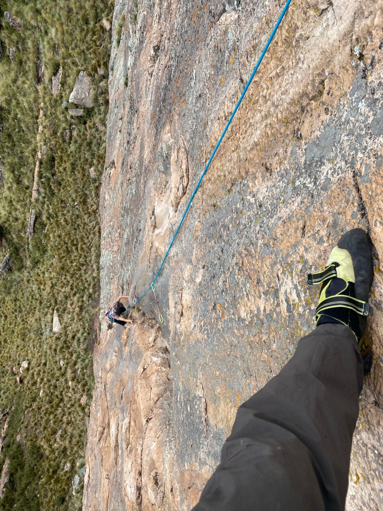
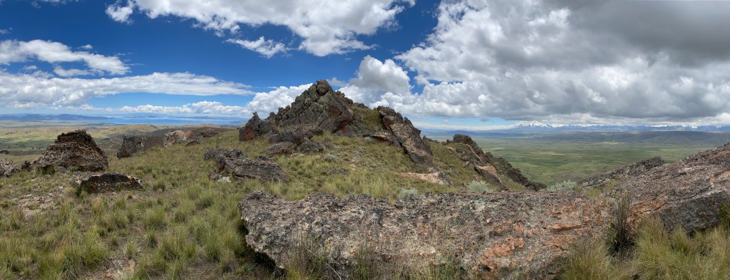
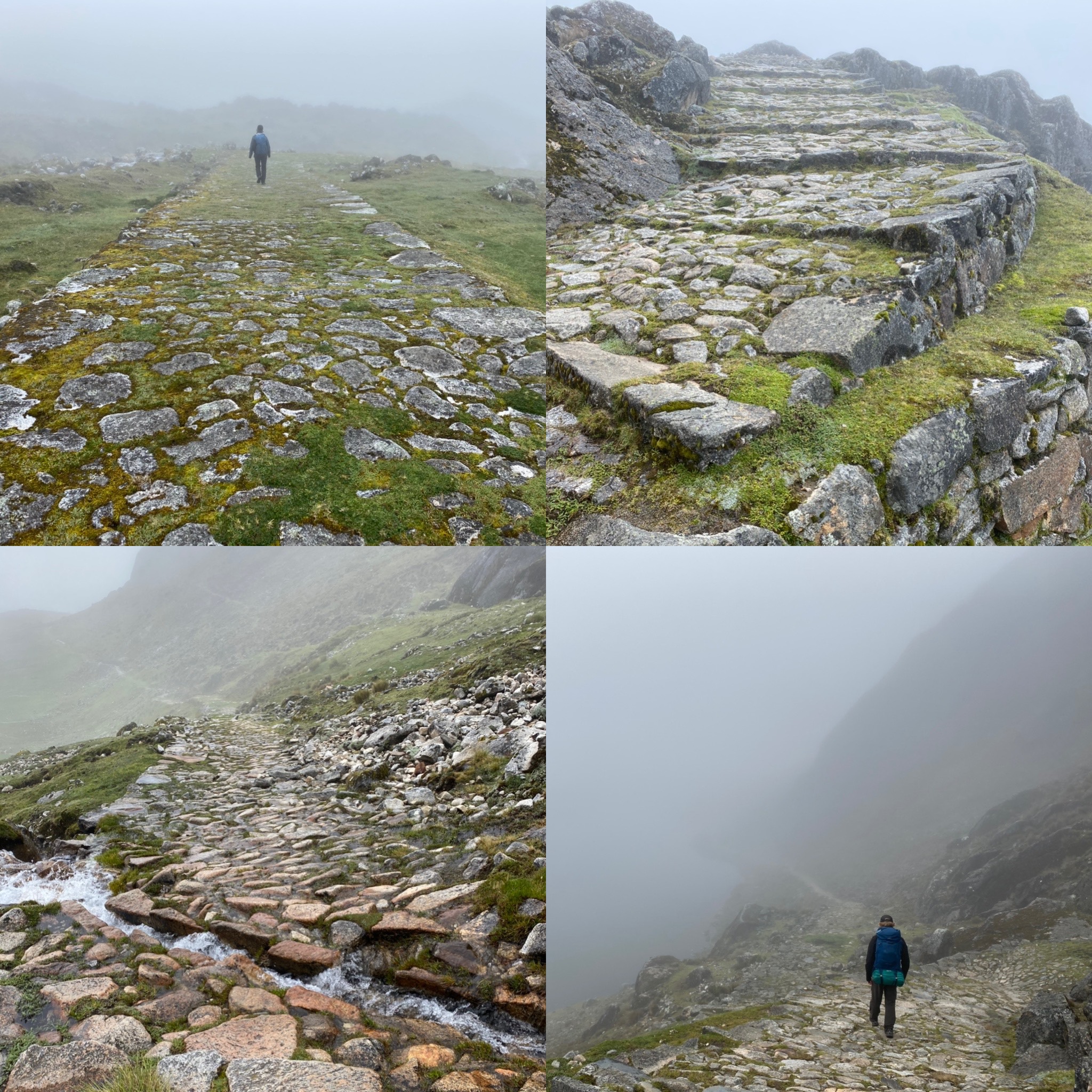
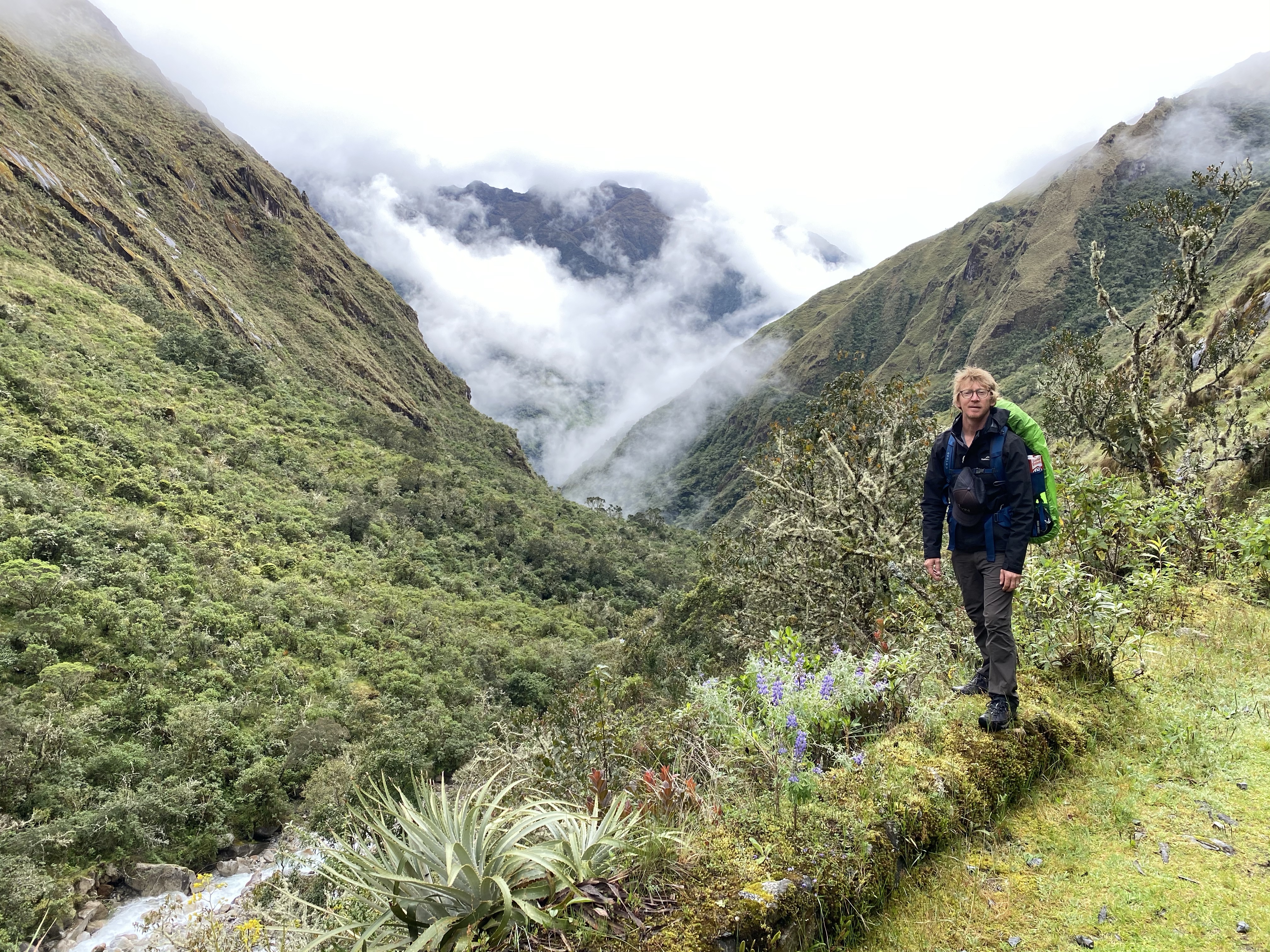
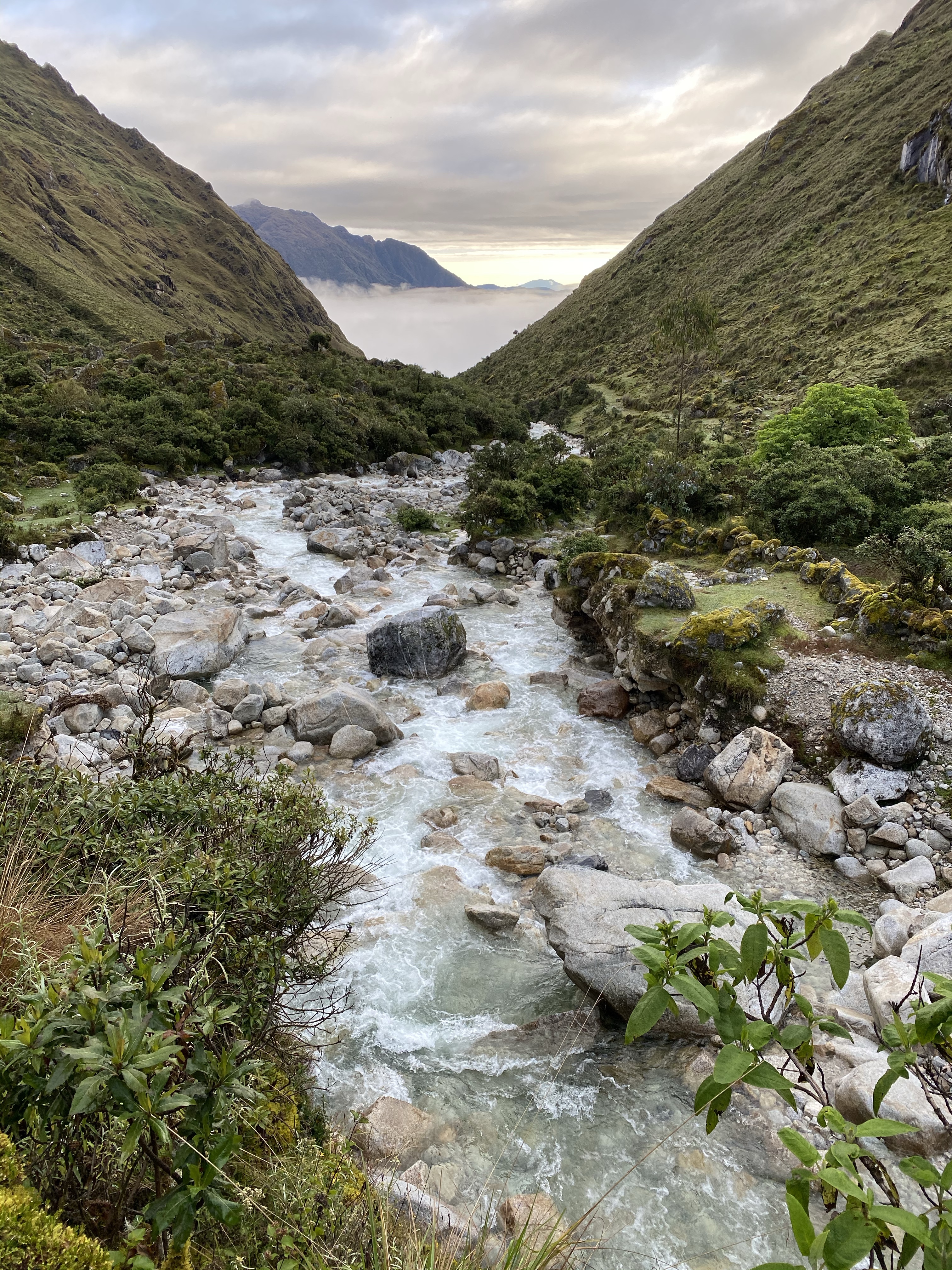
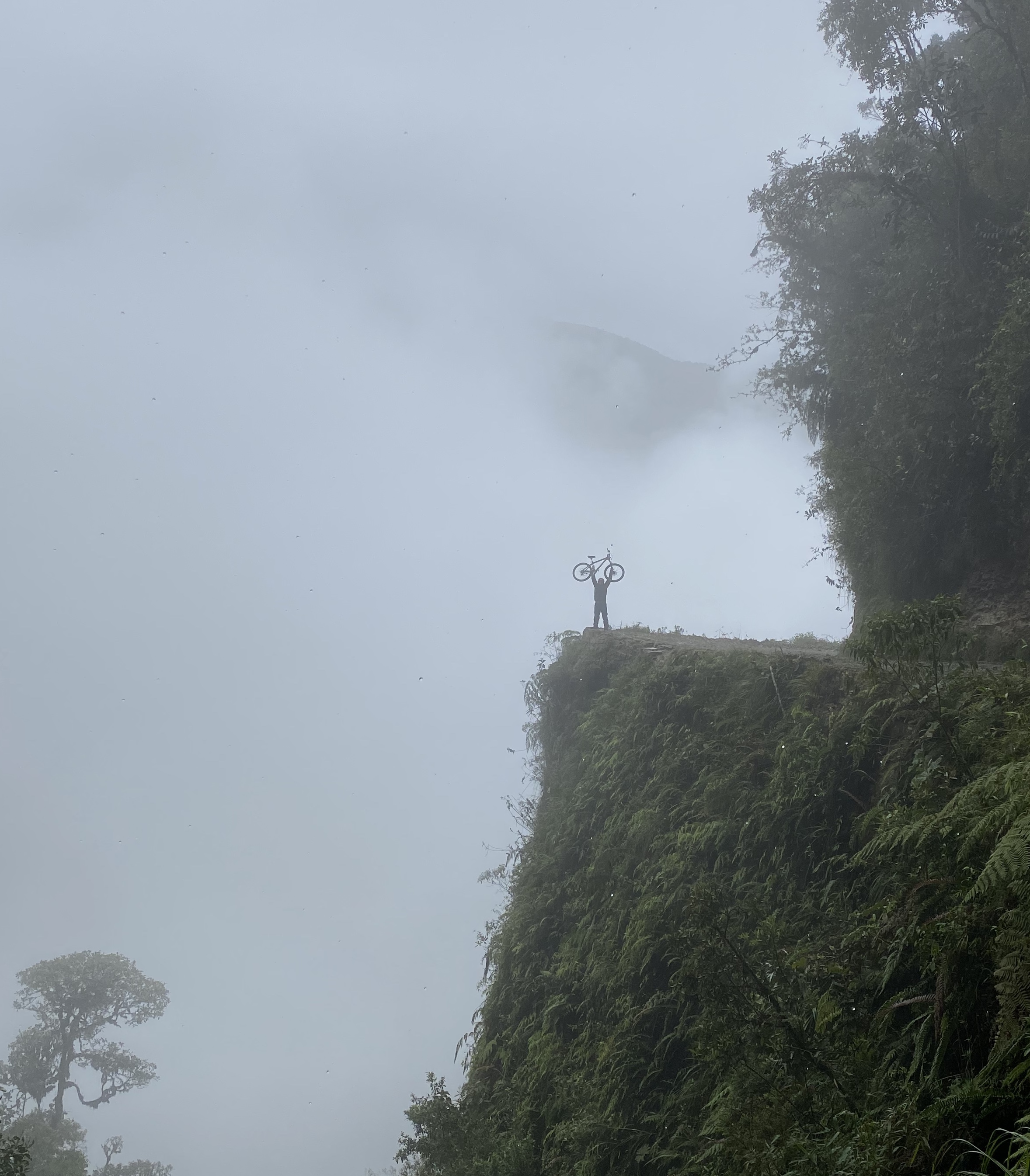
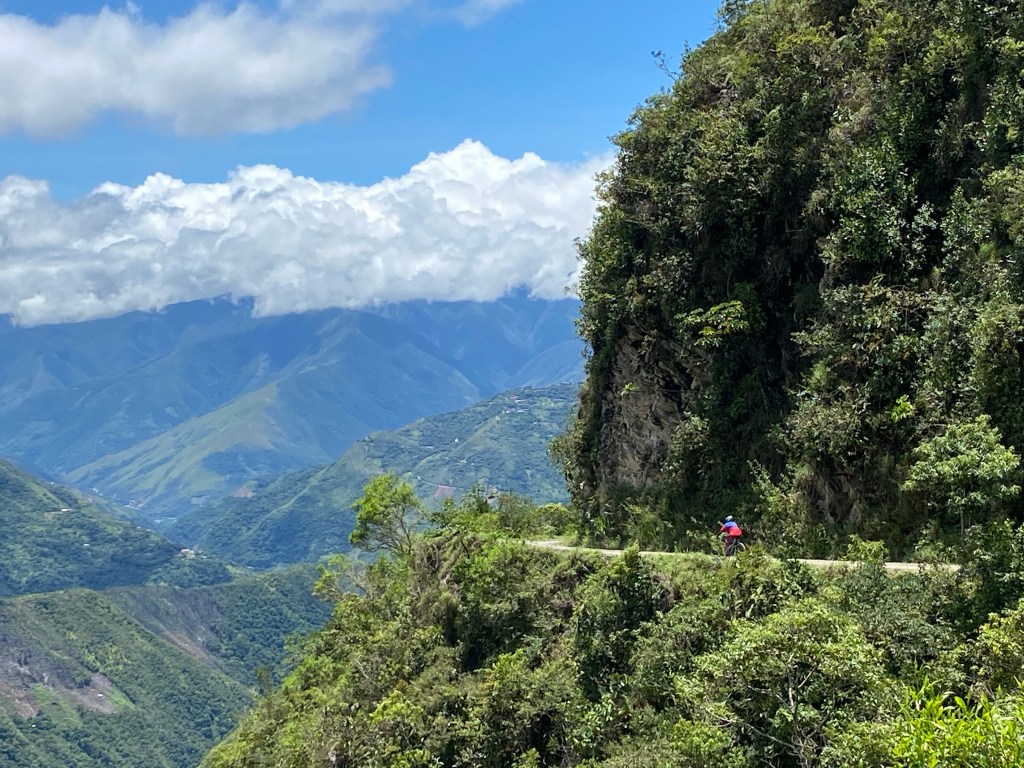
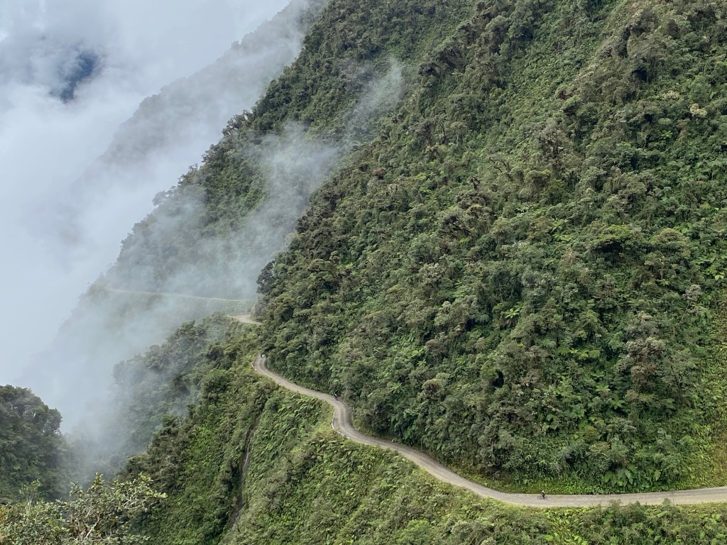
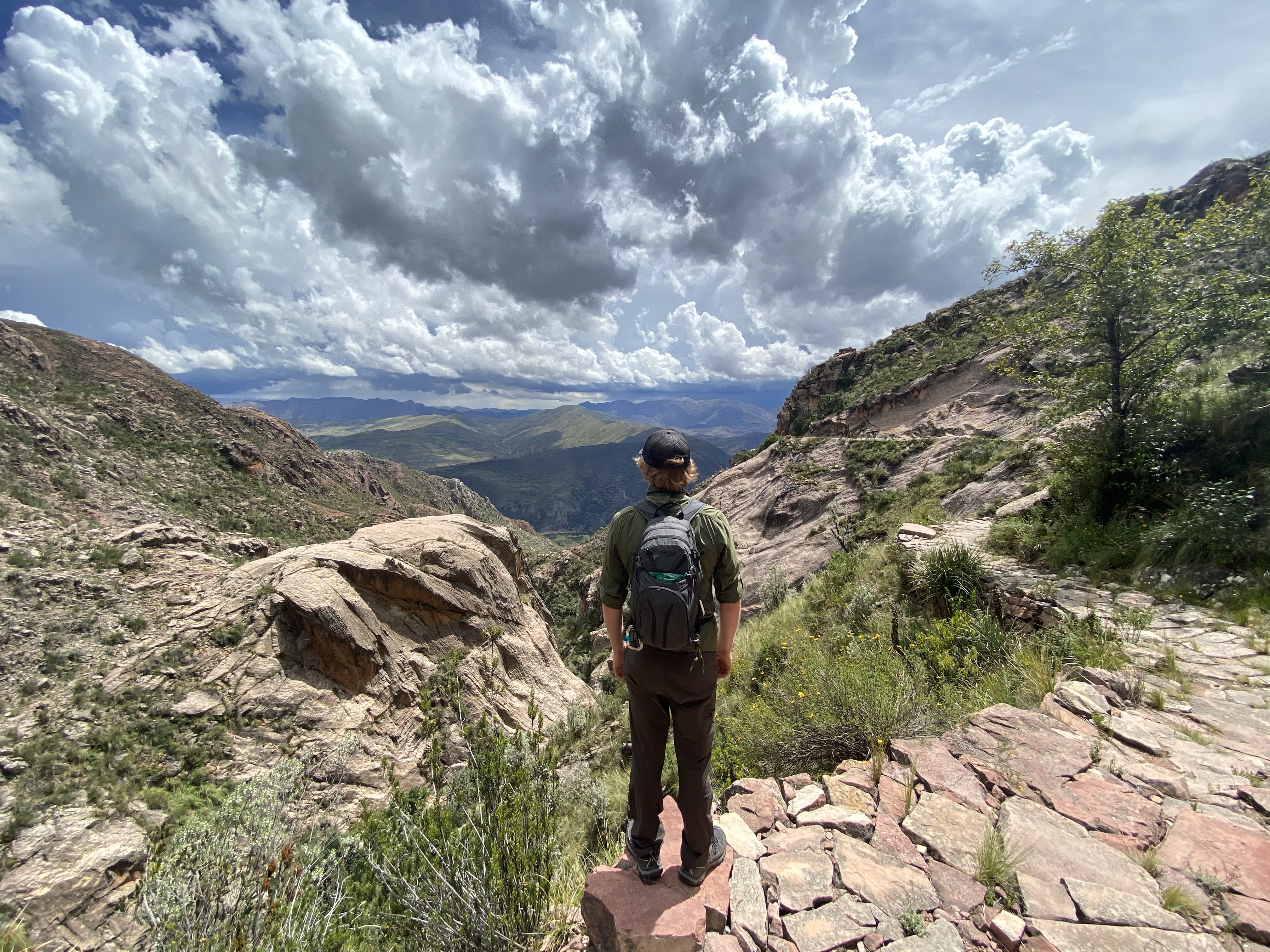
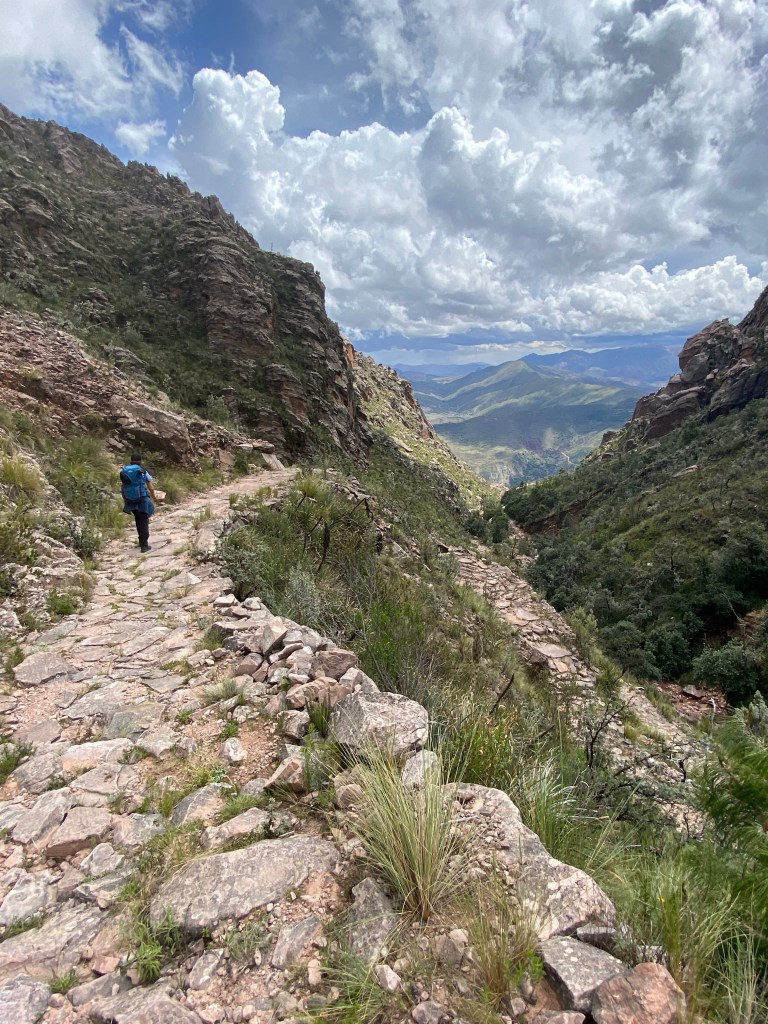
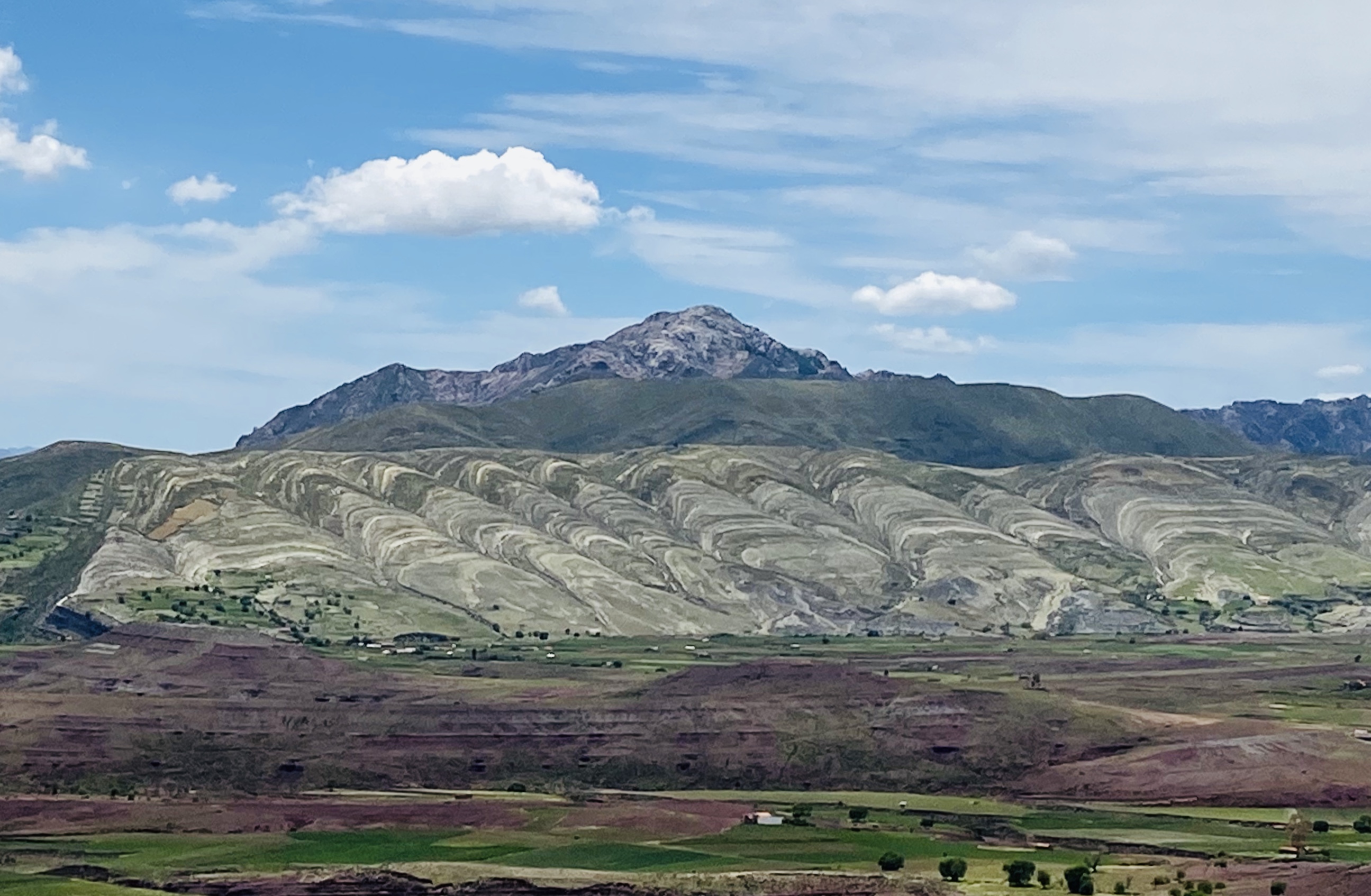
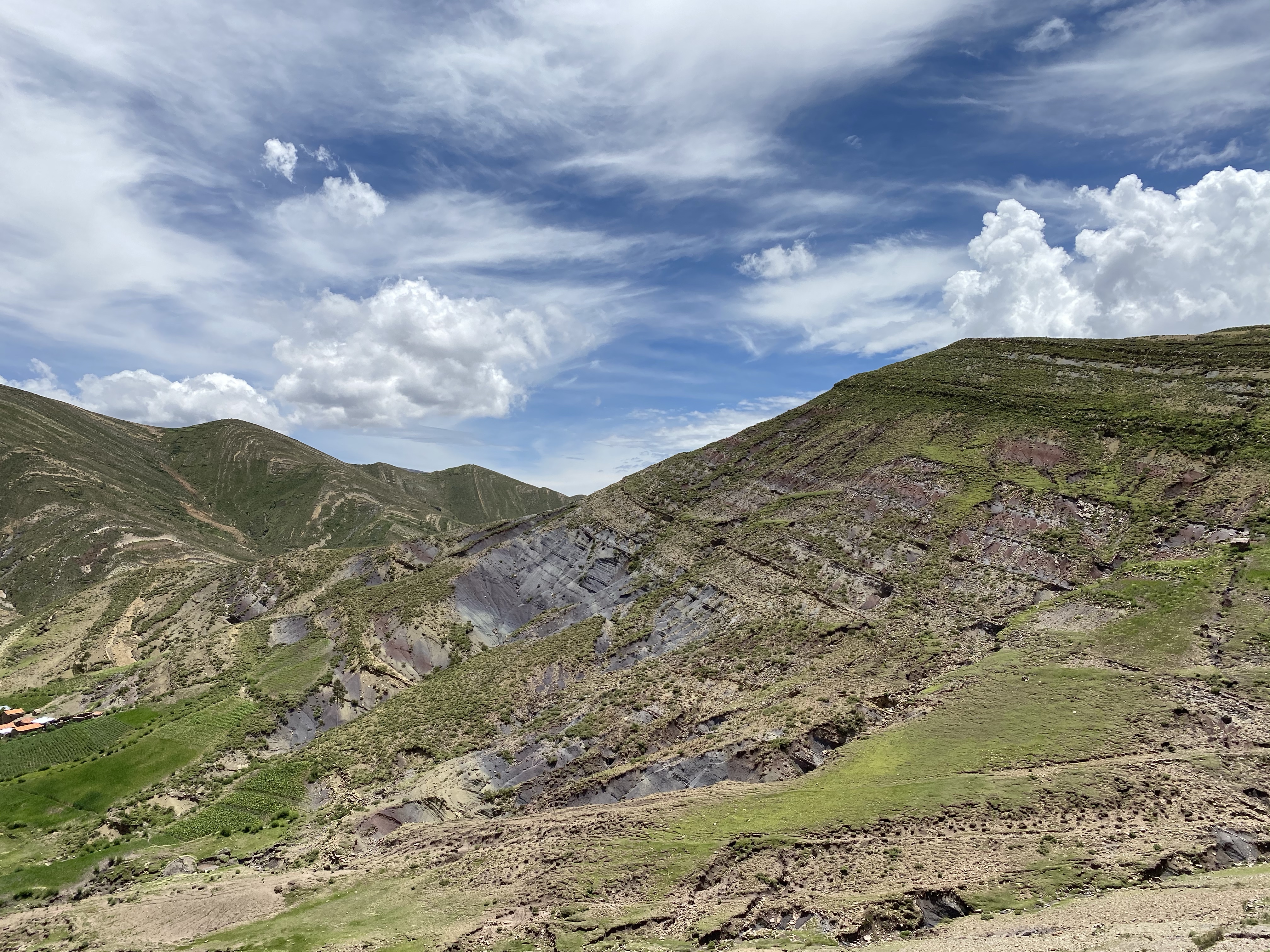
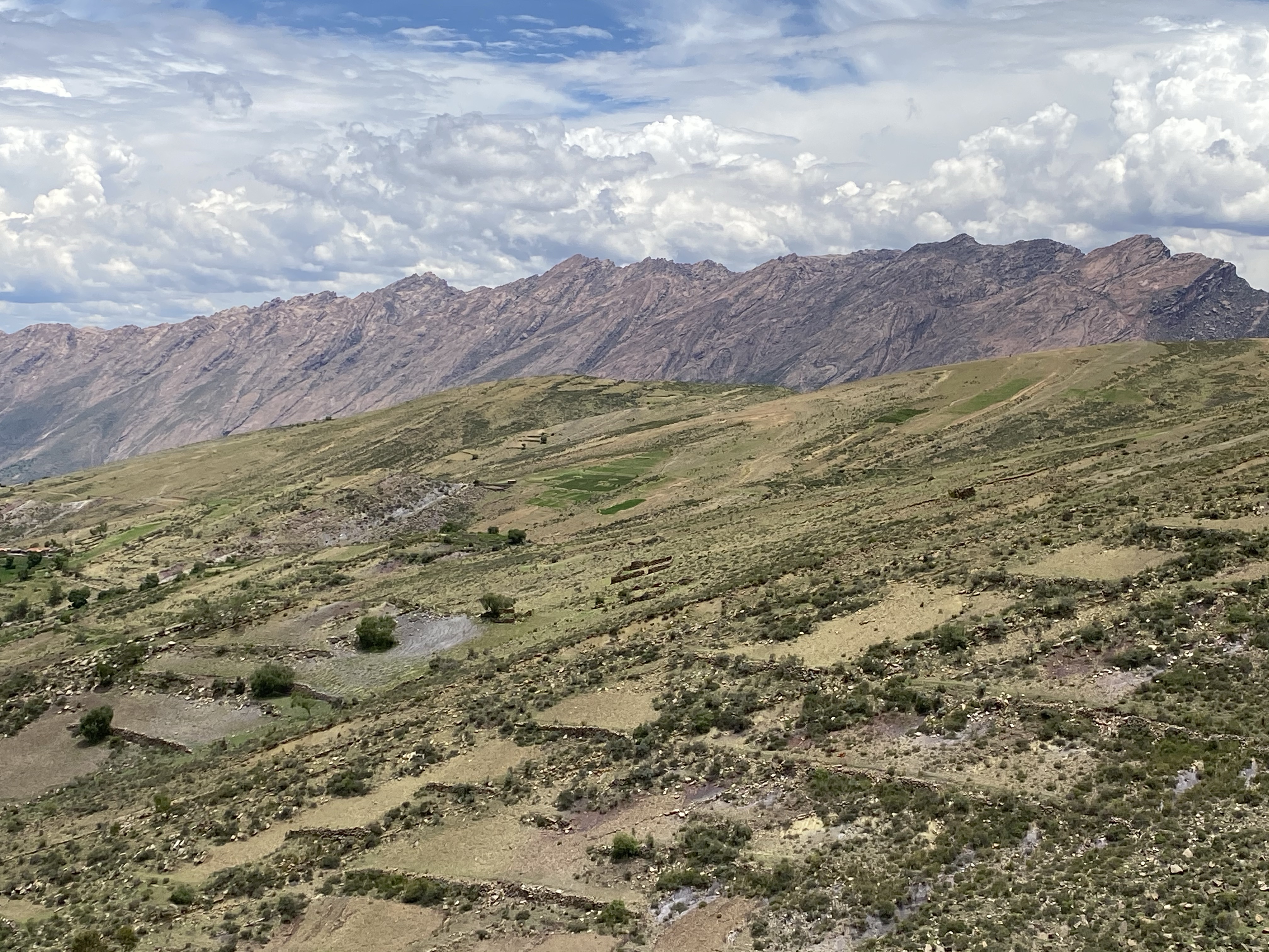
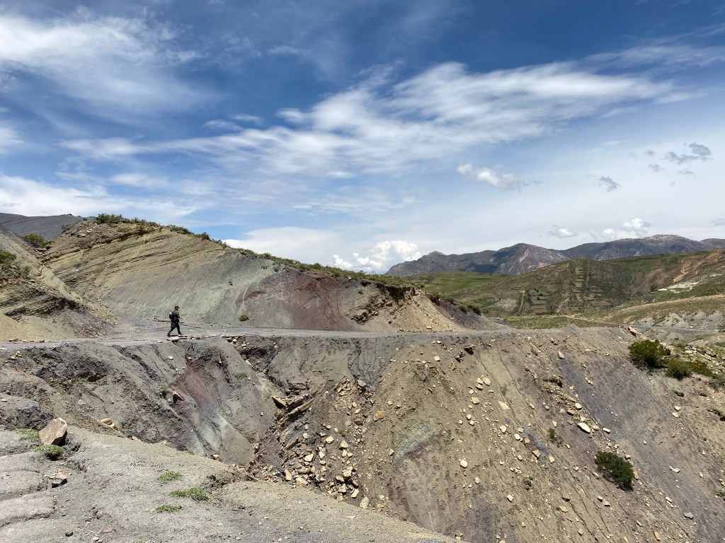
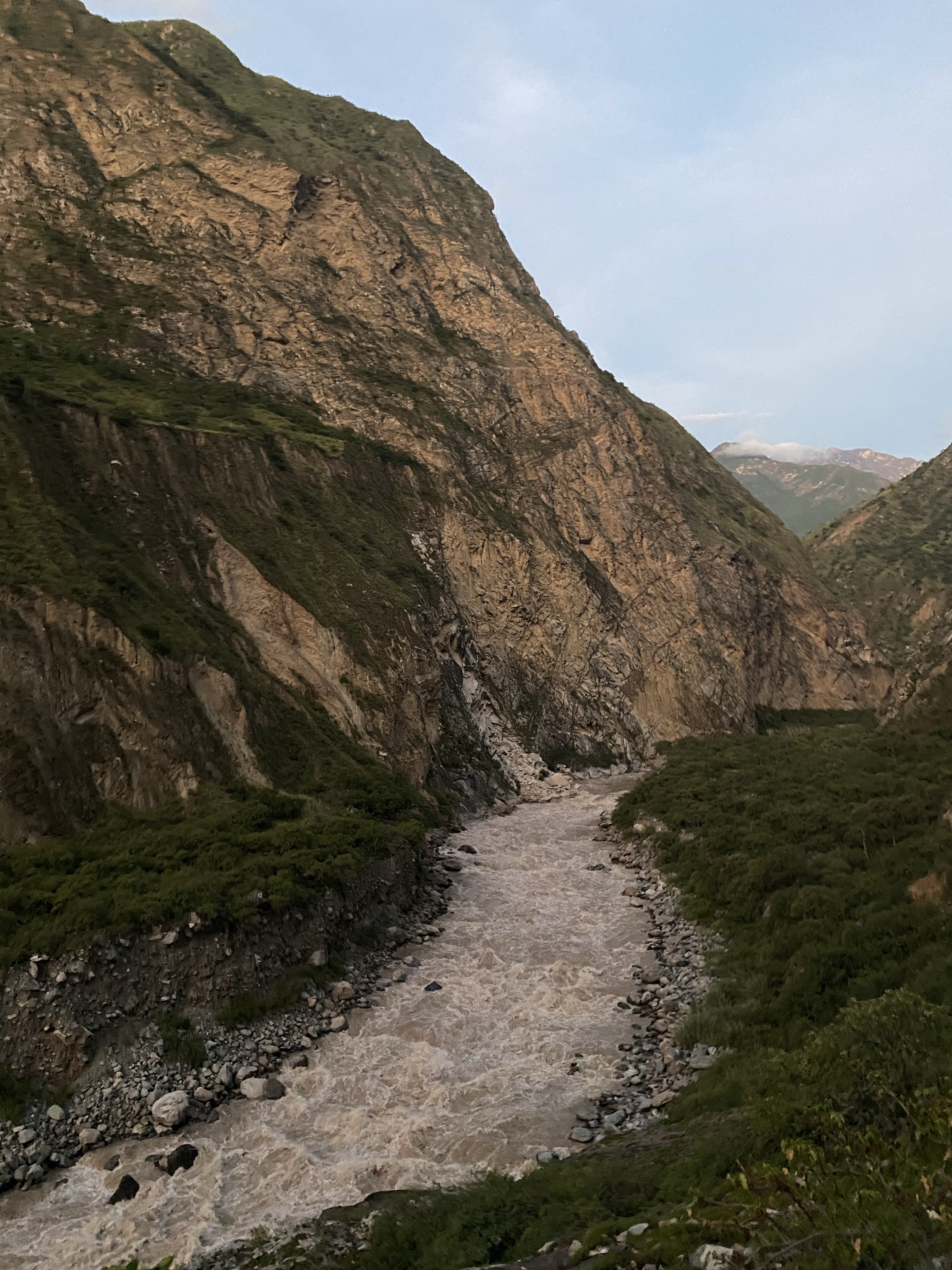
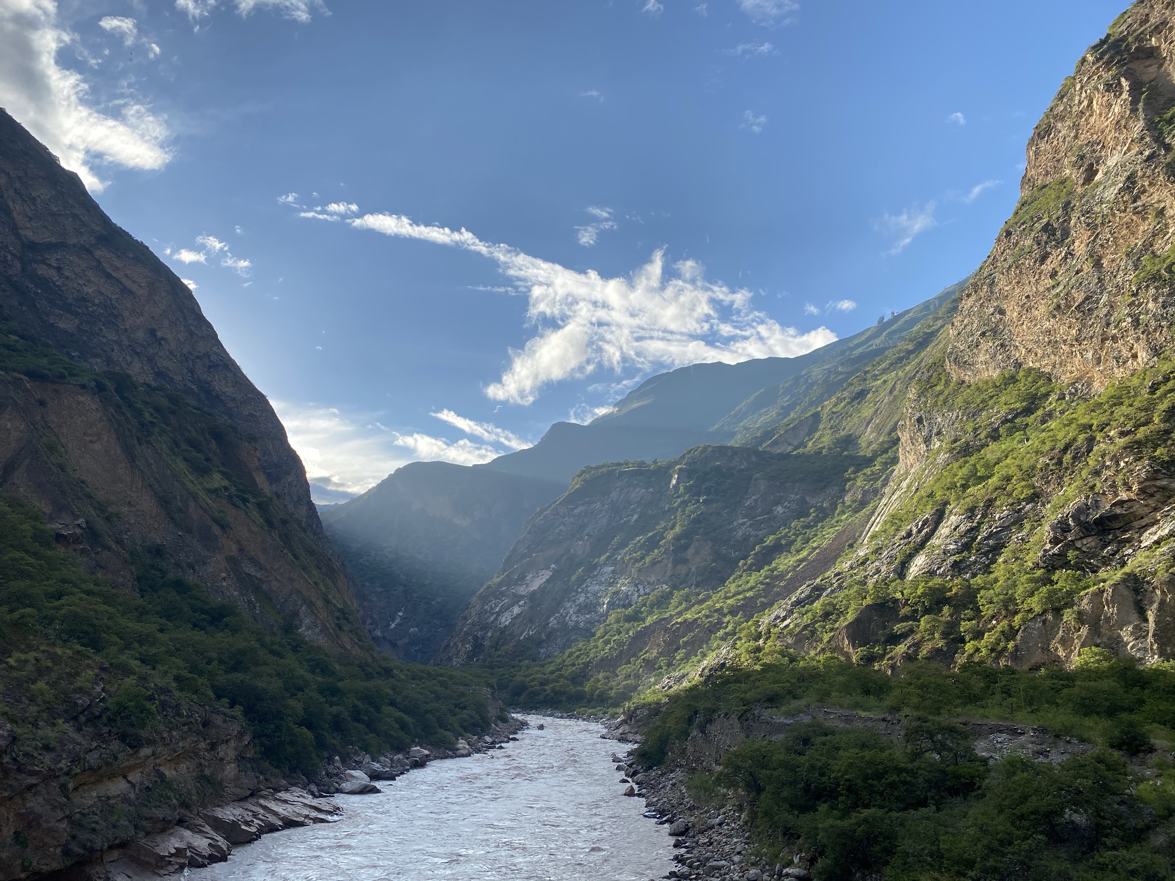
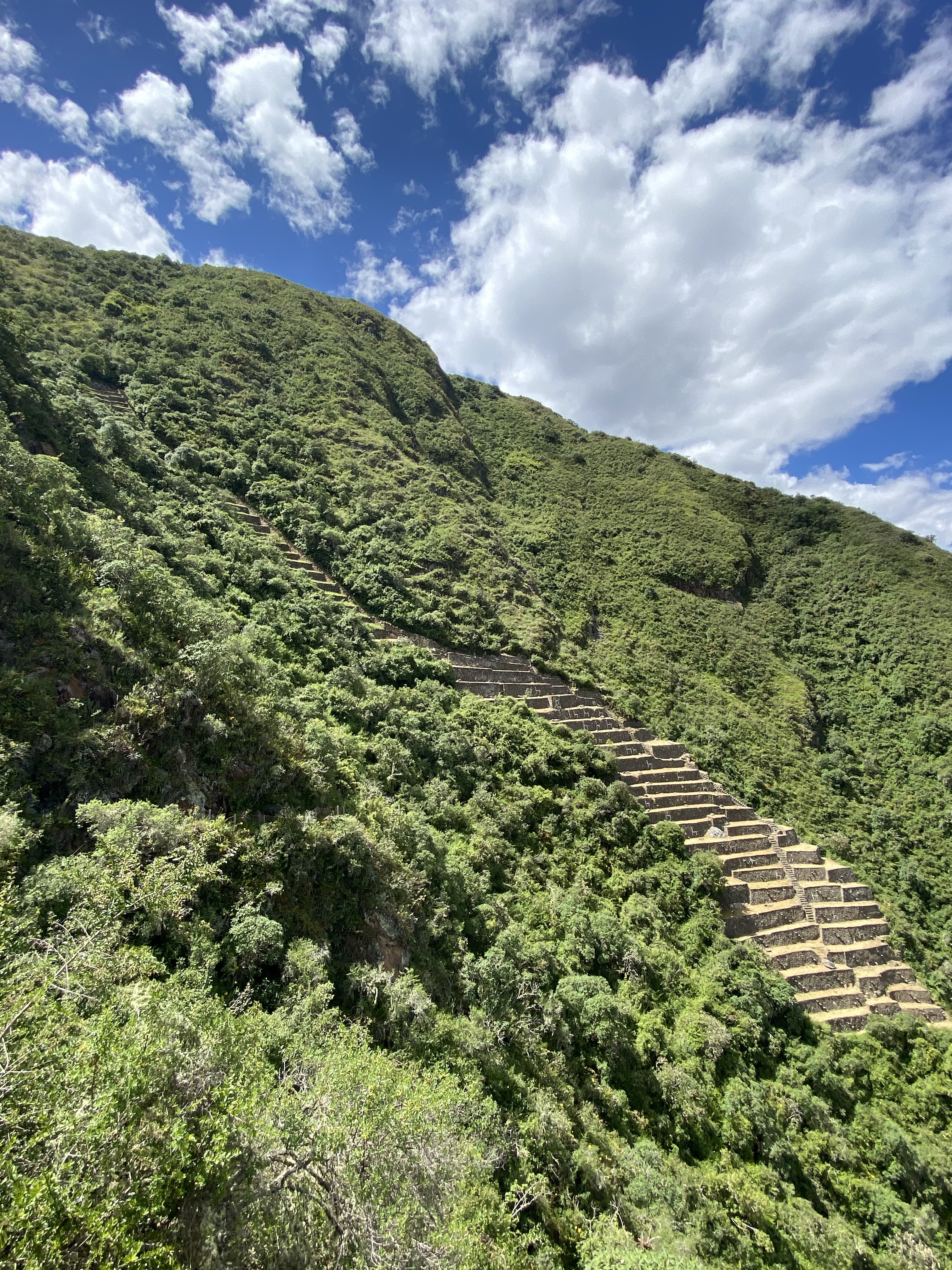
We made it to Capuliyoc safely. This restaurant, house, huts and camping space sits on the precipice of an enormous valley – stretching from the raging brown river at the bottom at around 1,500 meters above sea level to mountain peaks on either side at maybe 5,000 meters. This was the valley in which scene of our trek was set. Our challenge was to traverse down one side from 2,900 m to 1,500 m, and then back up the other side to 3,000 m to the ruins of Choquequirao. Both sides were steep, especially the Choquequirao side, and a view of the trek shows the enormous amounts of switchbacks (zig zags) it takes to ascend or descend fast without covering much distance.

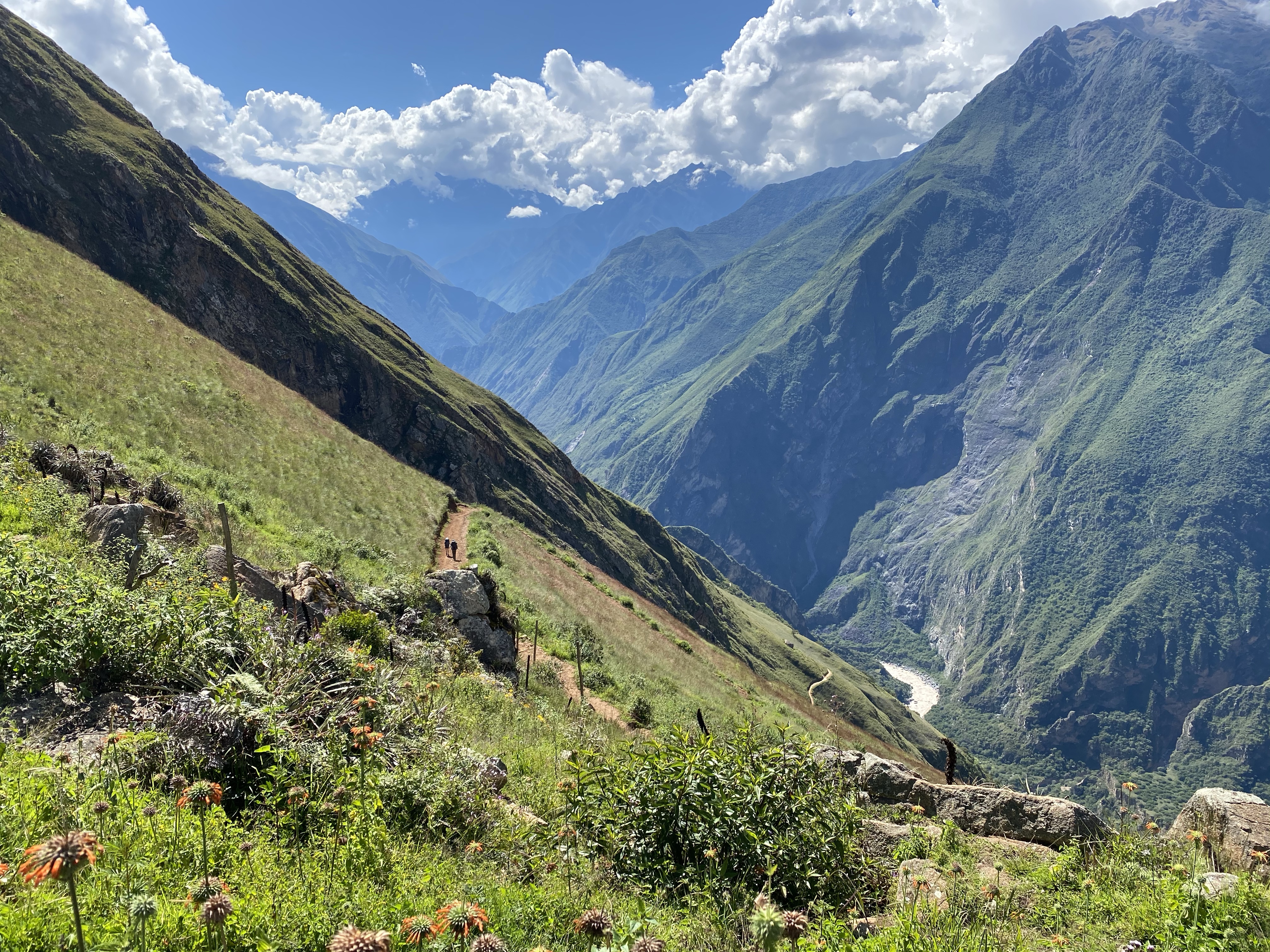
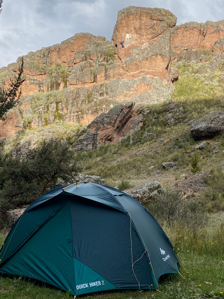
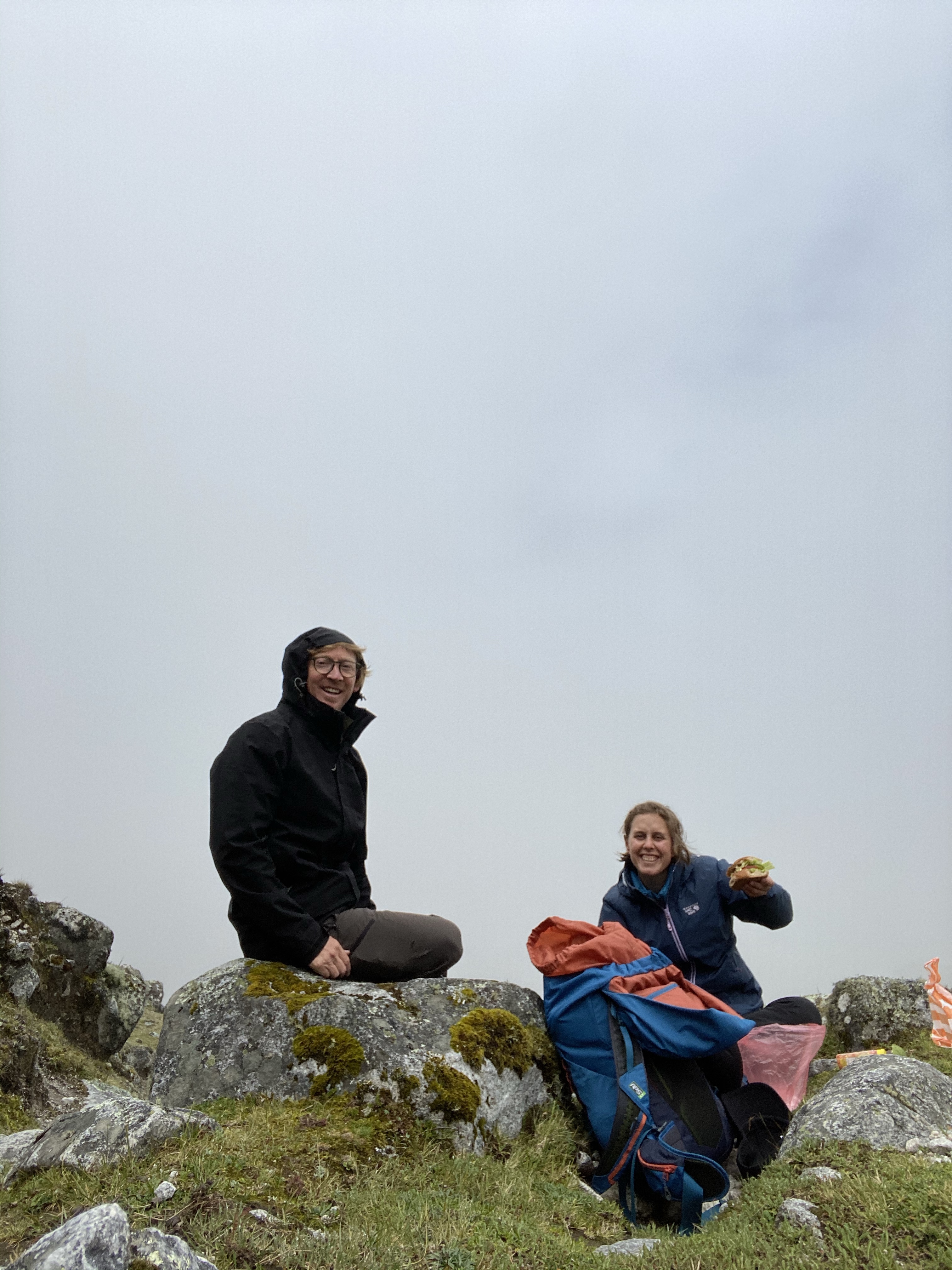
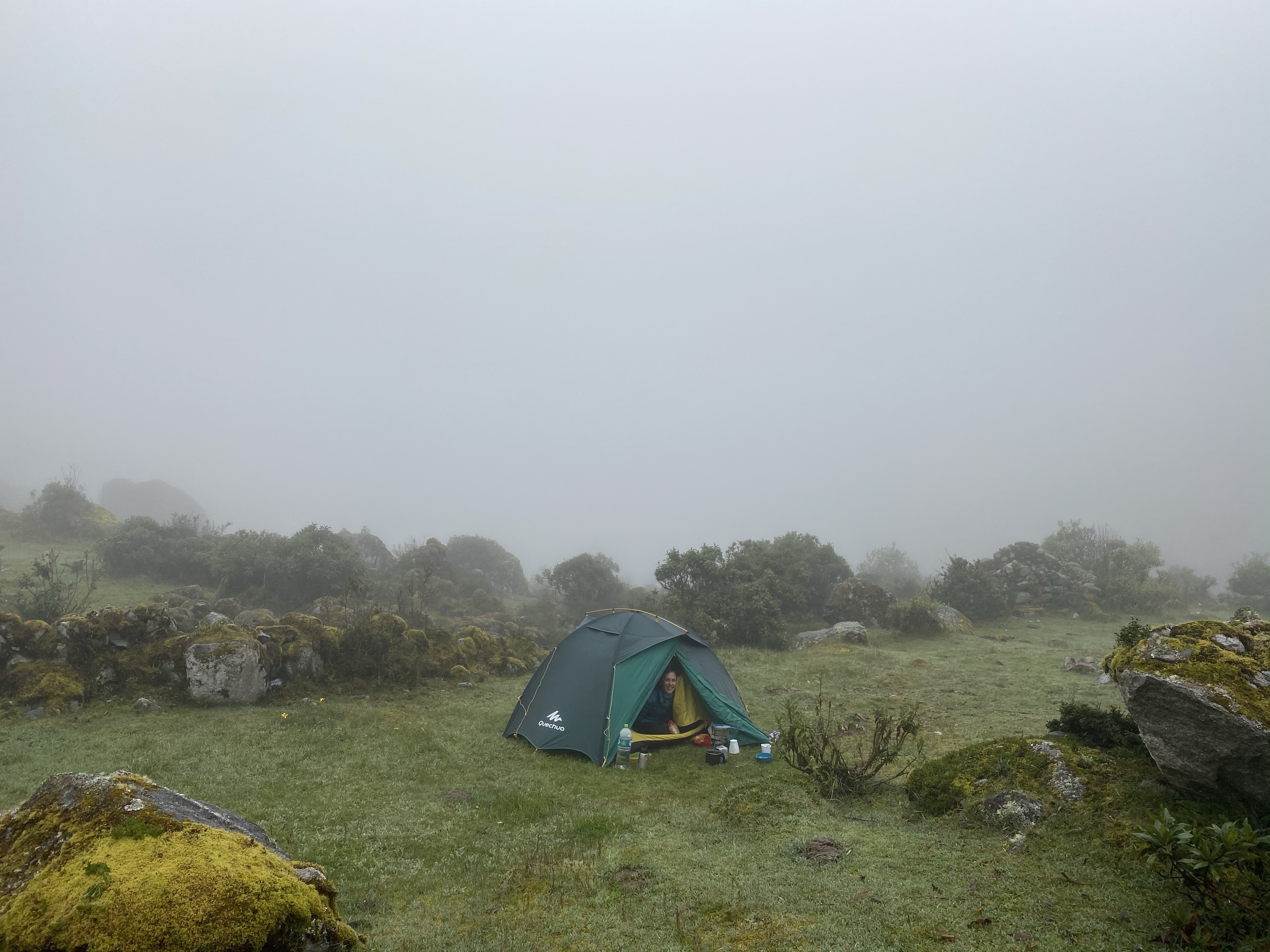
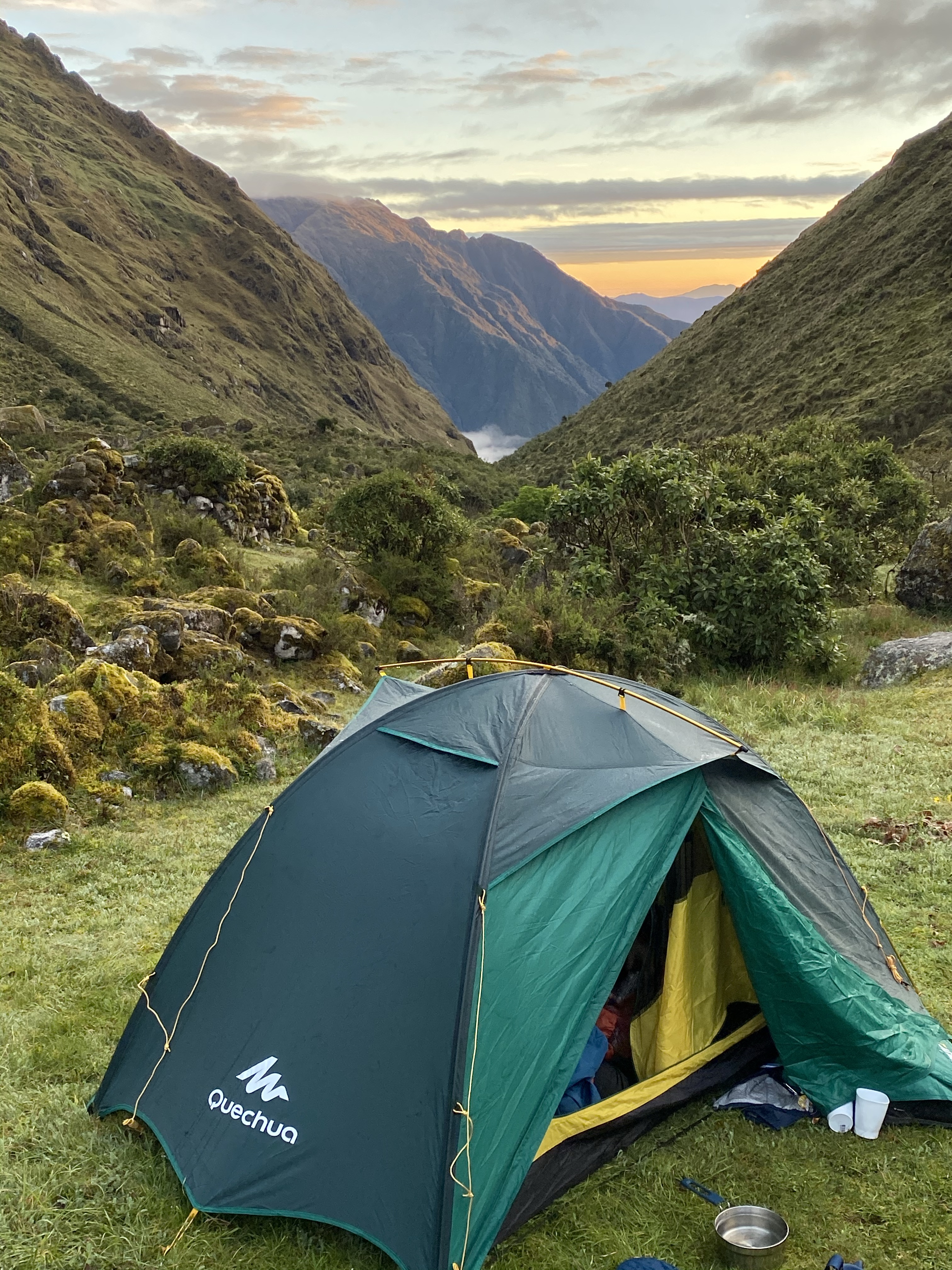
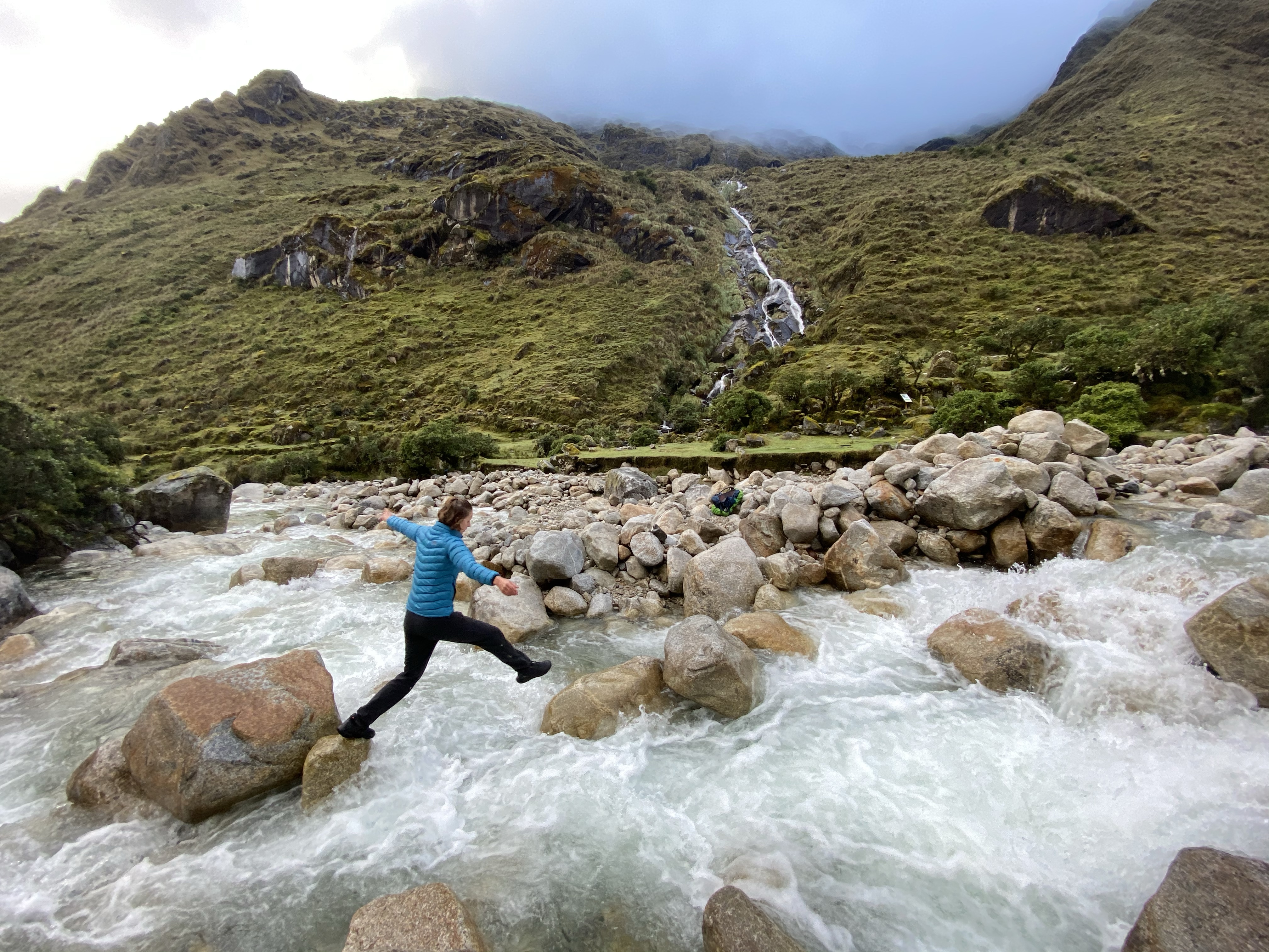
We accomplished the walk in four days – a half day on Monday afternoon descending into the cleavage of the mountains to the Playa; the next day up to Choquequirao (I’ll call it Choque for short now); a half day exploring Choque and a half-day descending to Santa Rosa Baja; and the final day returning to Capuliyoc. I’ve resolved not to dwell on the enormous difficulty and the resulting aches and pains of the walk because it doesn’t make for fun story-telling. Suffice to say it was a challenge carrying 10-15kg packs – and we were relieved on the final day to have a mule take our packs so we could make the final long ascent carrying very little. (If anyone is reading this for research, it’s worth noting that that day cost us 50 soles – not the 80-100 that other websites mention.)

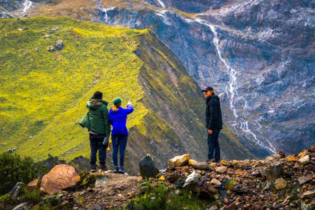
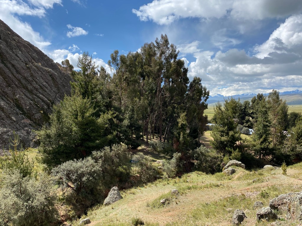
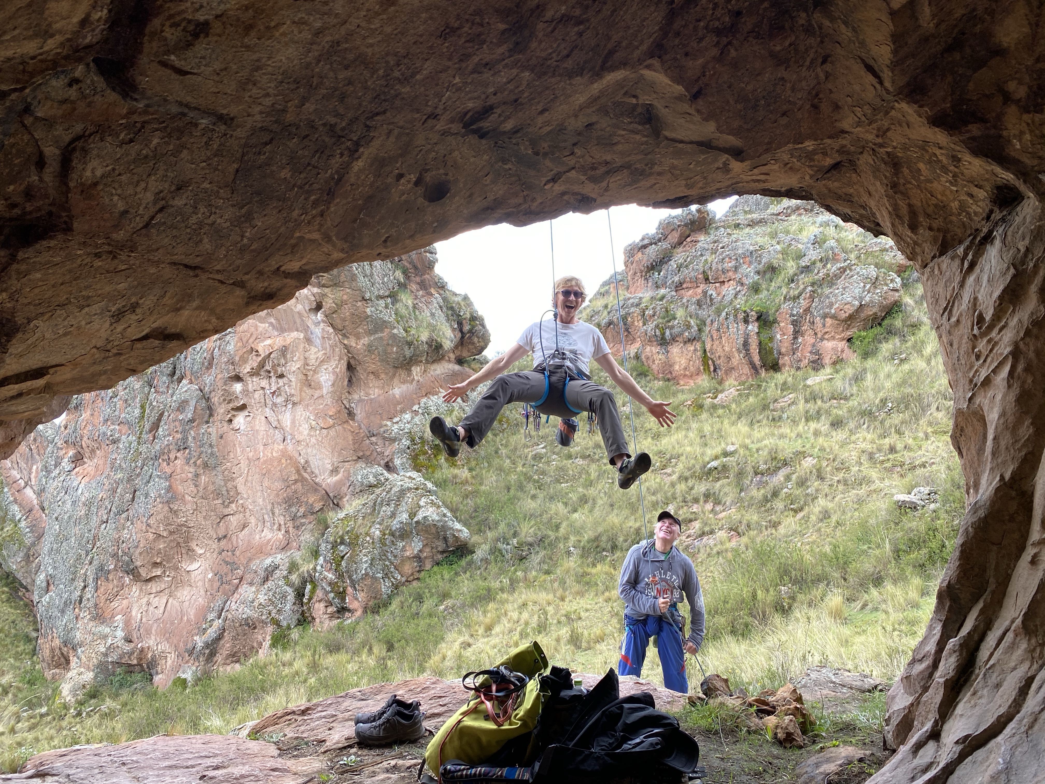
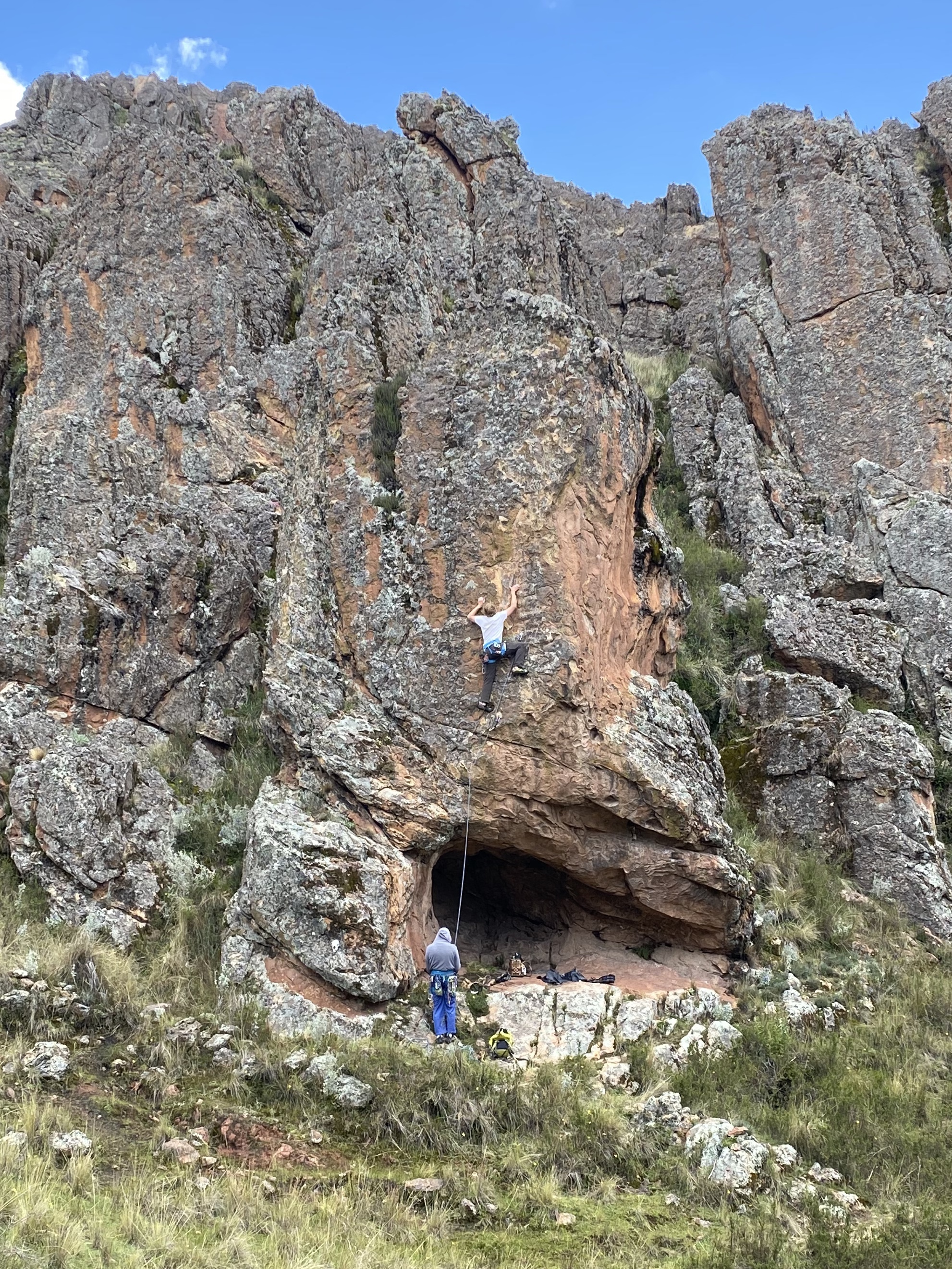
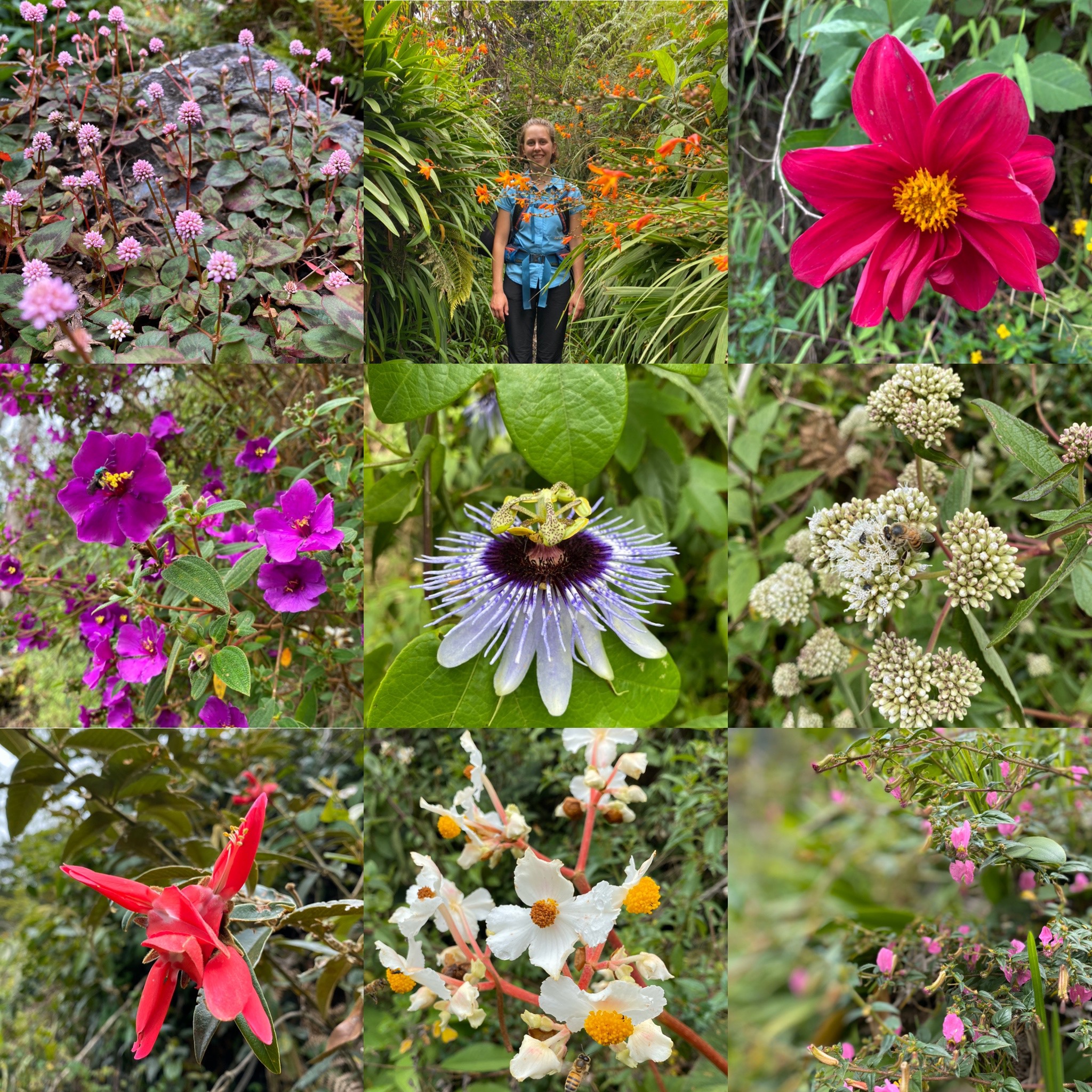
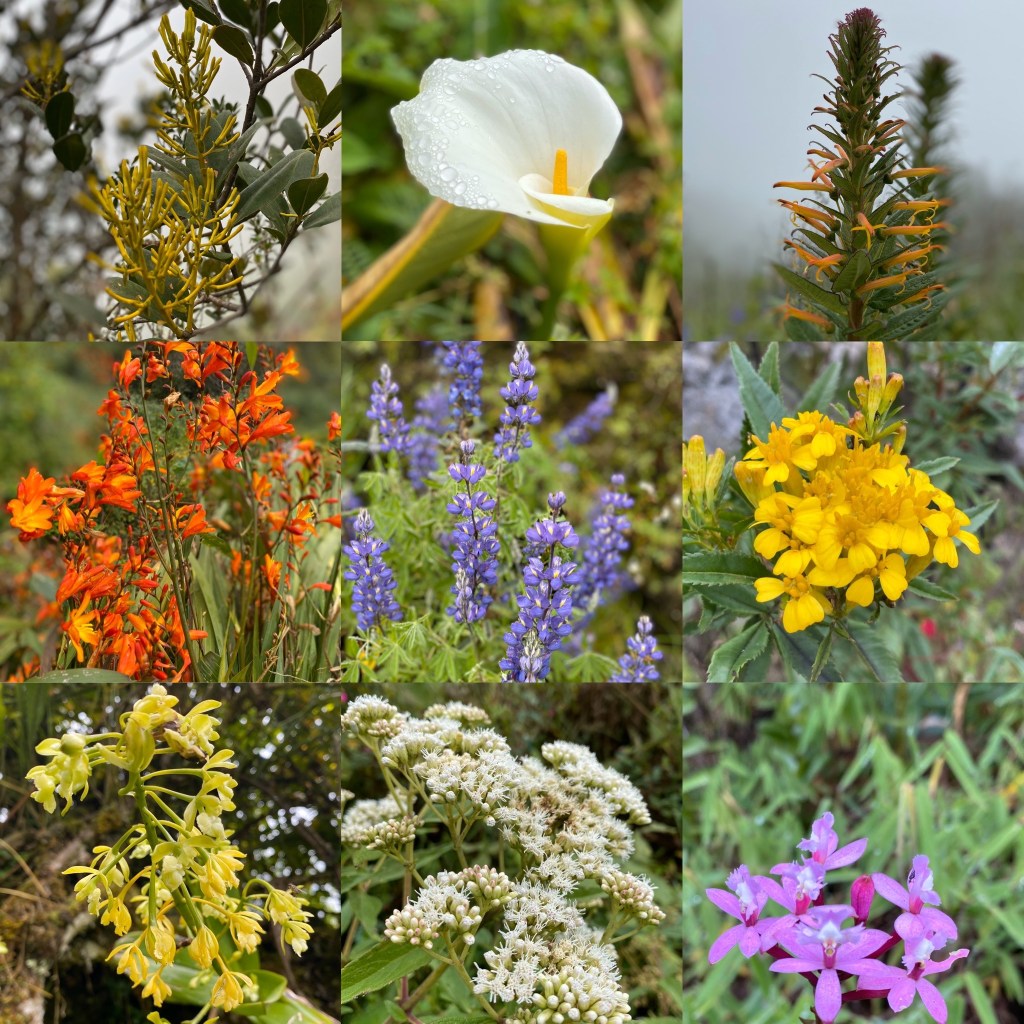
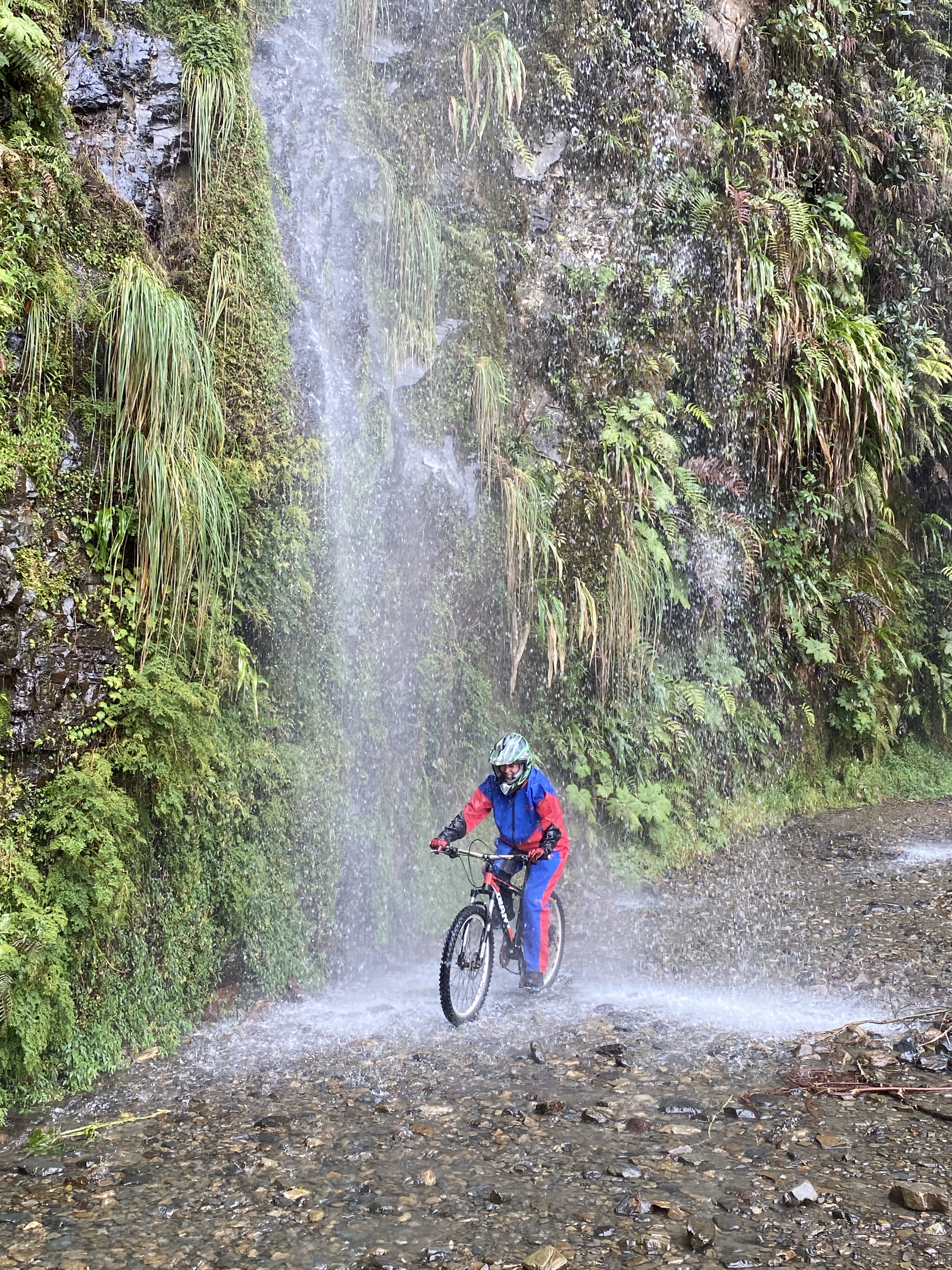
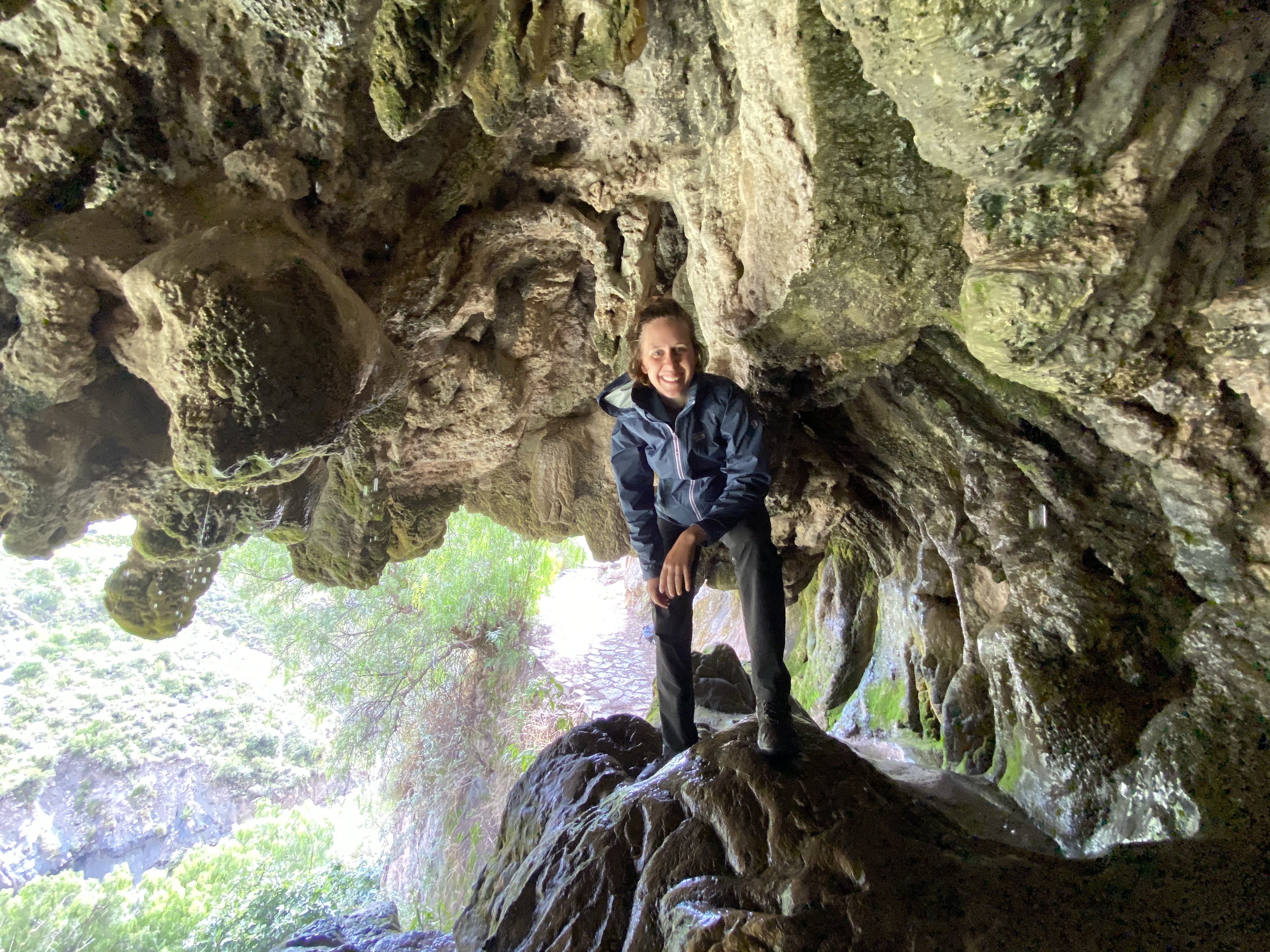
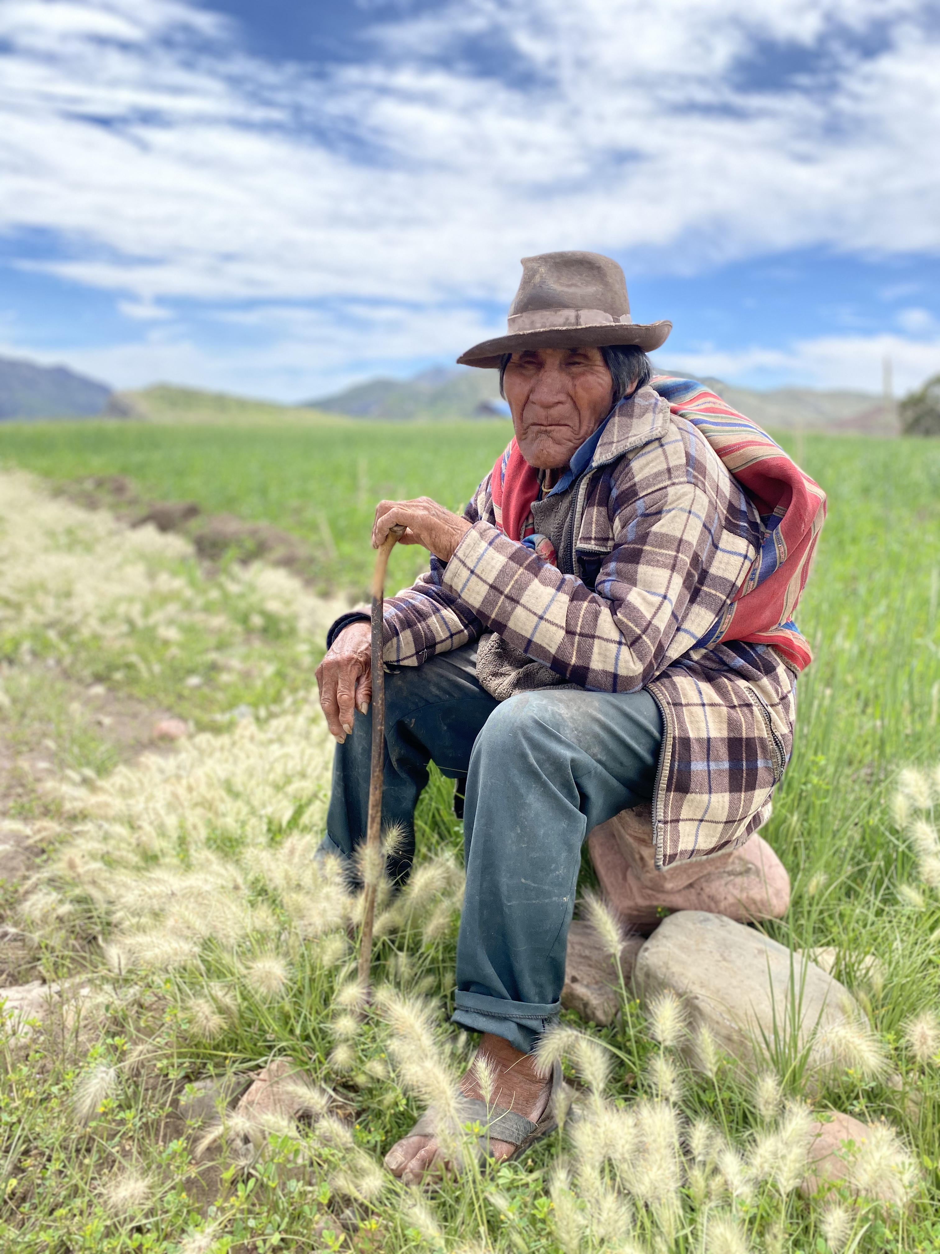
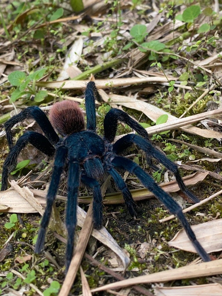
It was an incredible four days of birdsong, the distant roar of the river rapids, layers and layers and layers of sunscreen and insect repellant, blazing sun and shady rests, expansive views of rock crags and landslides, waterfalls to drink from and bathe in, a steady stream of muesli bars and choc chip cookies, simple but delicious lunches, overburdened fruit trees whose fallen fruit wasn’t being collected, achieving micro-milestones with the completion of each switchback, the brightest, richest yolks of the free range eggs, 7 pm bedtimes, three enormous hairy spiders, flies of considerable size, the shrill song of cicadas, the myriad colours of wildflowers, and the afternoon sunlight illuminating the leaves.

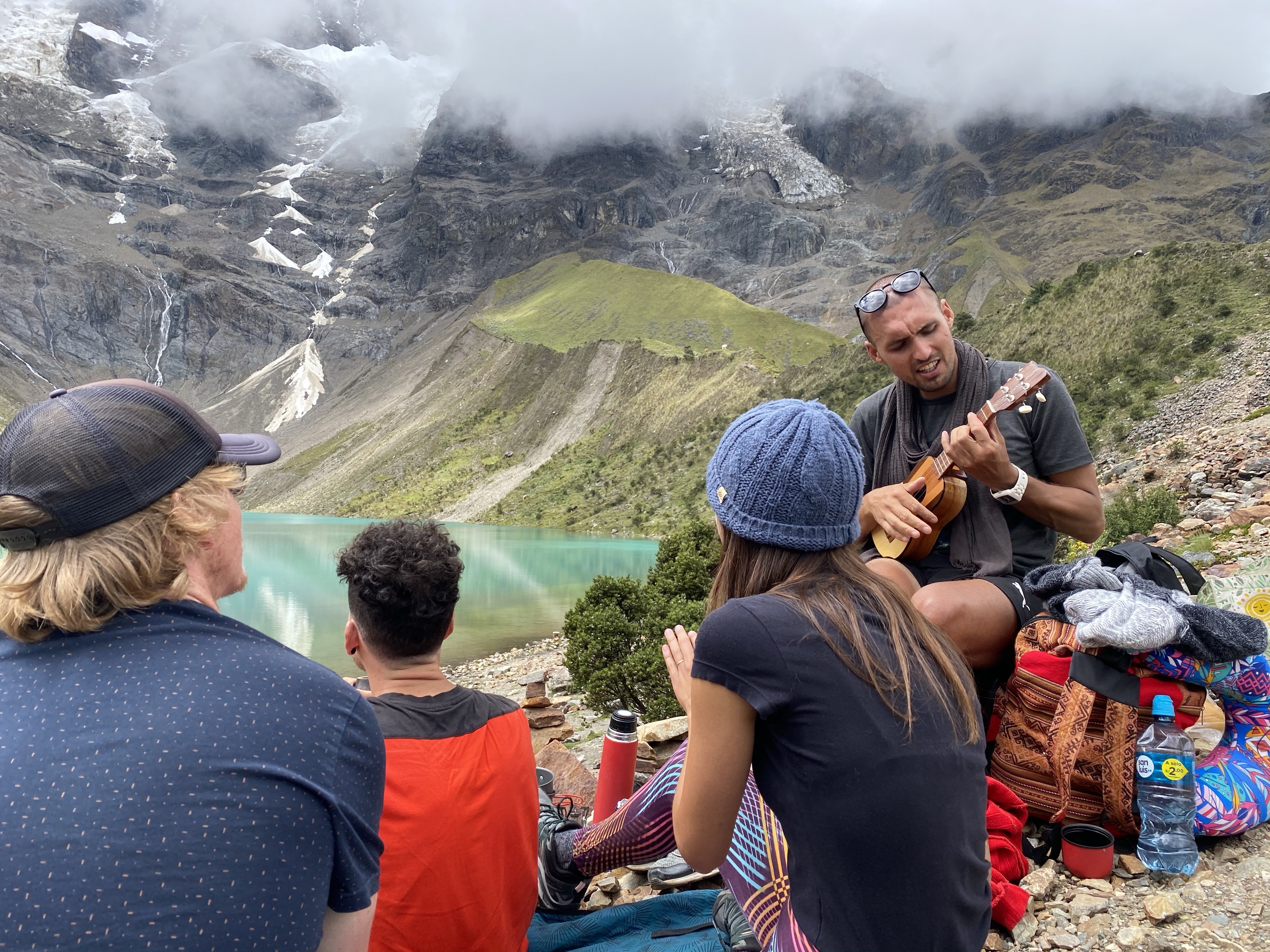
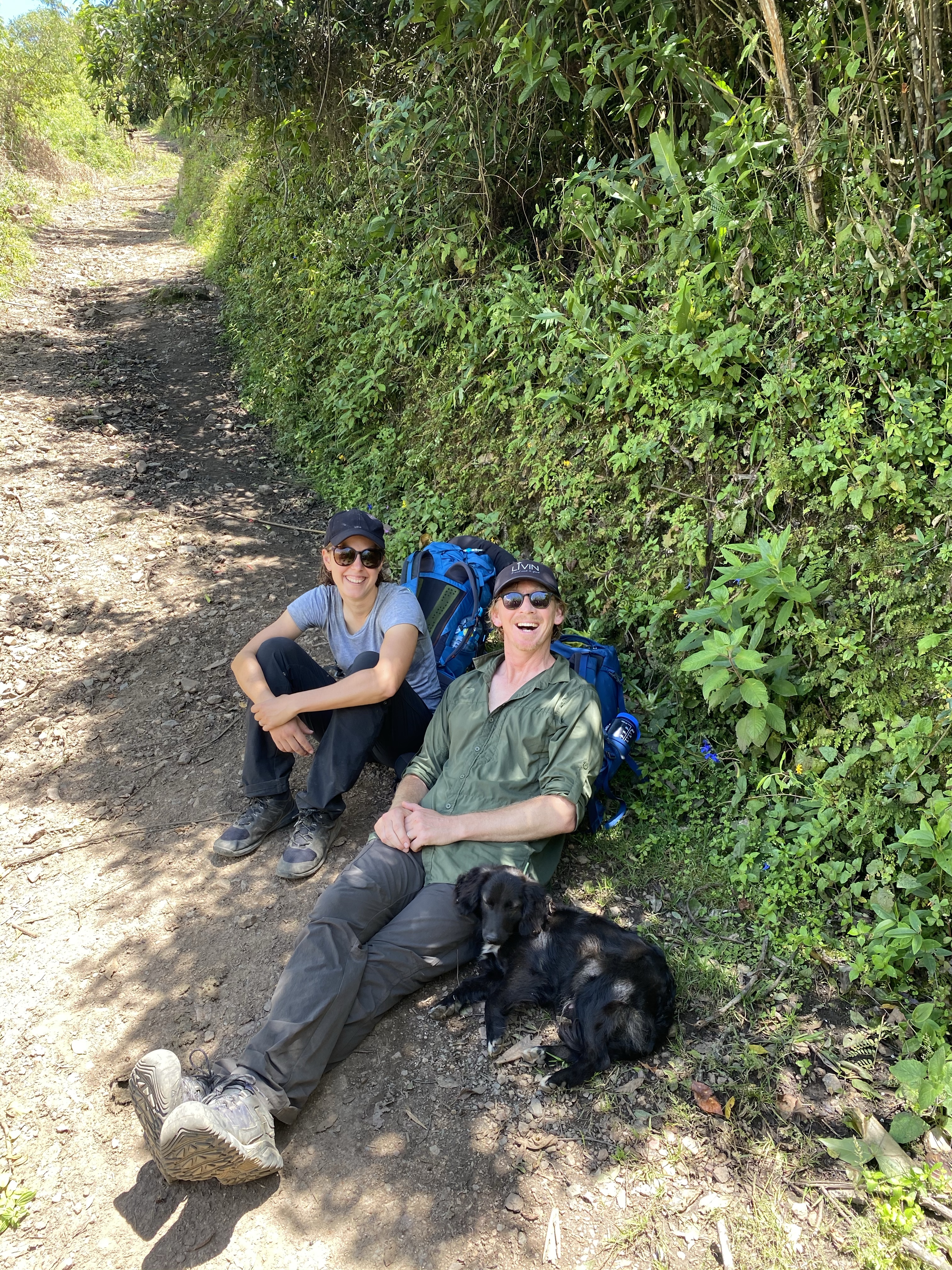
And the other semi-constant in our four days was crossing paths with Heather and Jack and their puppy companion, named Benny but more often just called ‘Pooch’, who joined them at the entrance office to the trek and walked with them the entire way there and back. Benny was a delight – a young, spritely, black-but-brown-in-full-sun pup with big fluffy ears and a polite but vivacious spirit.

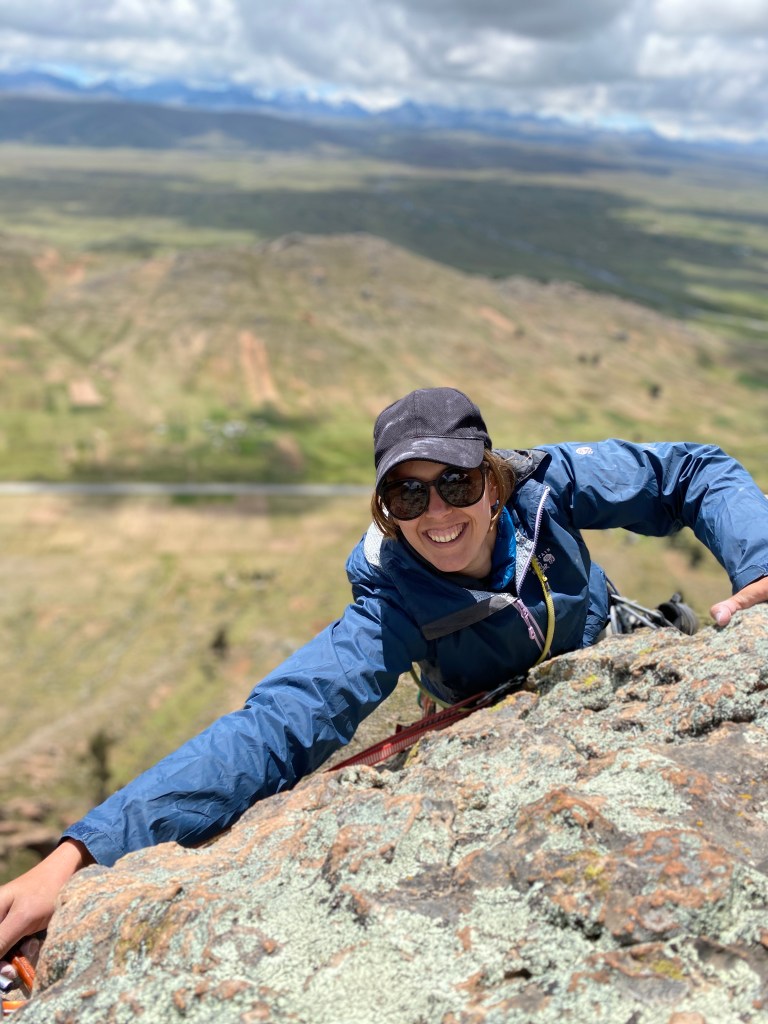
On the trek, we also had the joy of tranquility. We passed few people on the trek, and only ever shared a campsite with Heather and Jack (apart from the final night at Capuliyoc where we stayed in a cute cabin with a killer view). After setting up camp at Choque on Tuesday, the four of us explored the ruins as twilight set in. The next morning, for the first few hours, Dan and I were the only two people in the archeological site.

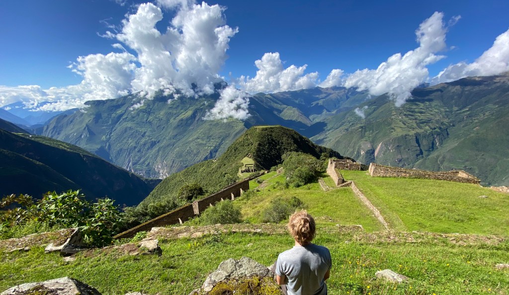
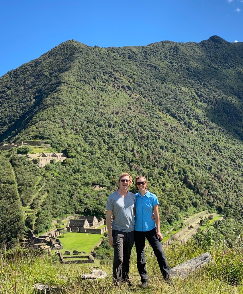
The complex is extraordinary – especially as what has been uncovered is probably only 40% of the site. It’s relatively close to Machu Picchu, which is just over a mountain range or two. Like Machu, it is perched on a ridge with an incredible view of the valleys around and is largely made up of stone buildings and enormous terraces. Unlike Machu, it is not swarming with people (we heard that selfie sticks have been banned and visits there are limited to four-hour blocks of time). Choque is surrounded by jungle which continually threatens to reassert it’s right to the ruins, and keeps the maintenance people busy keeping it at bay.

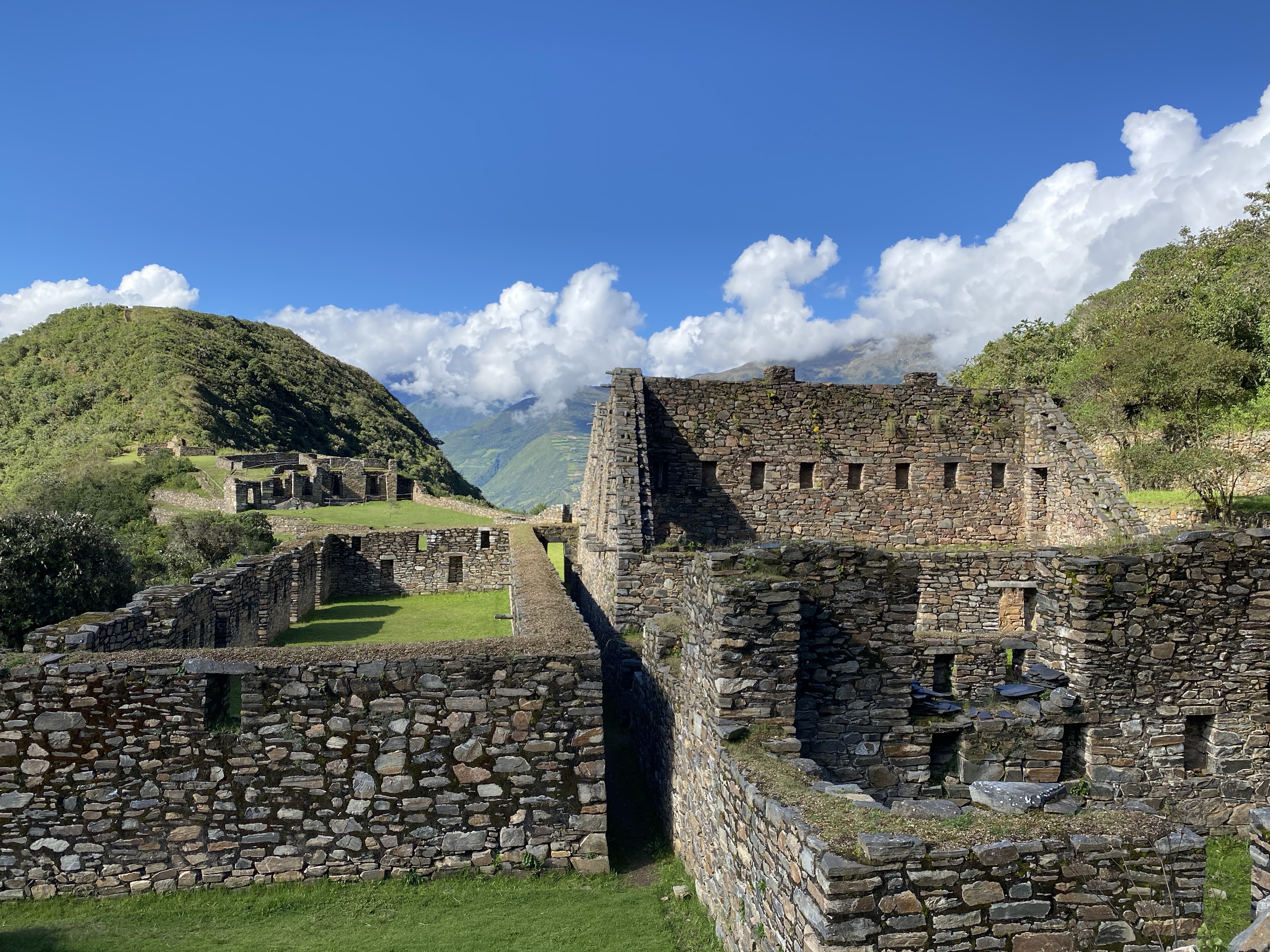
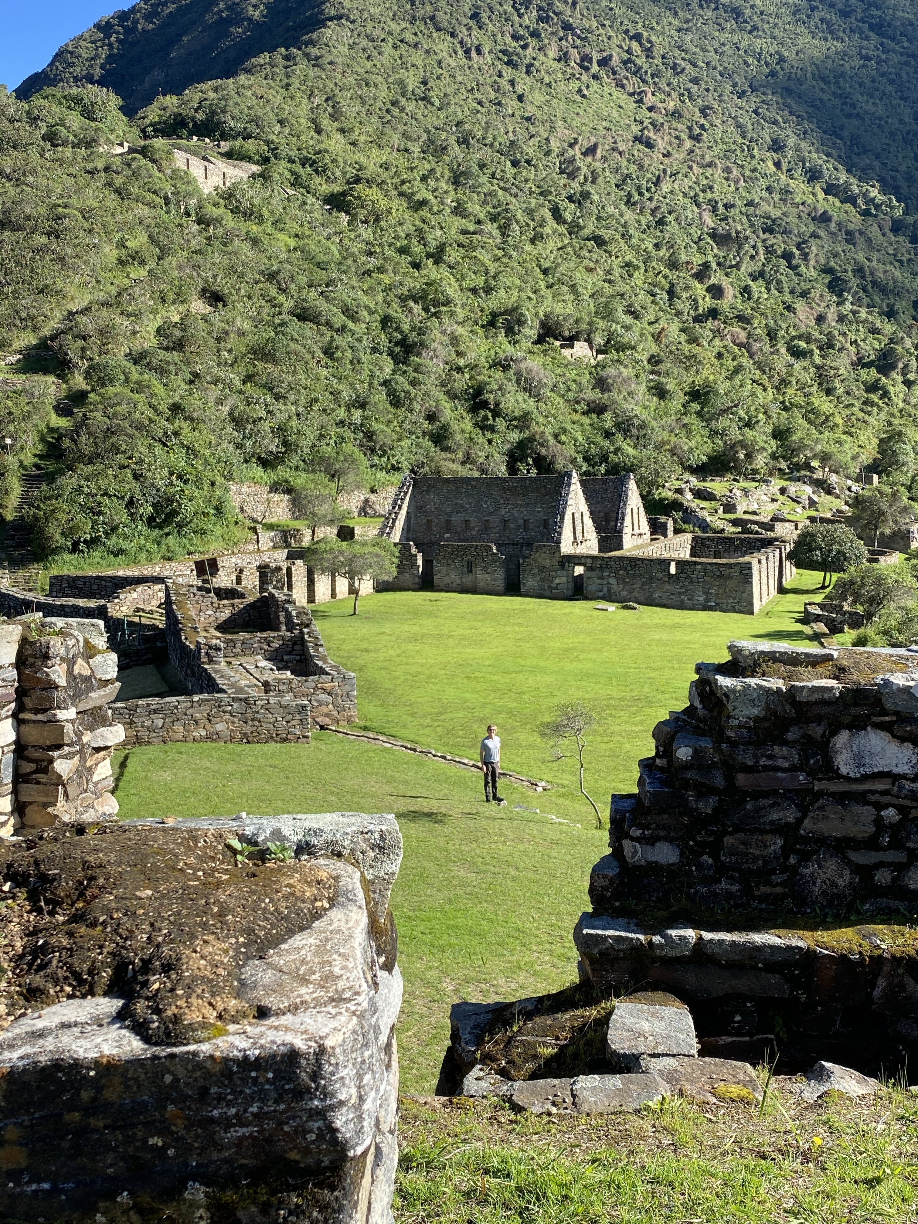
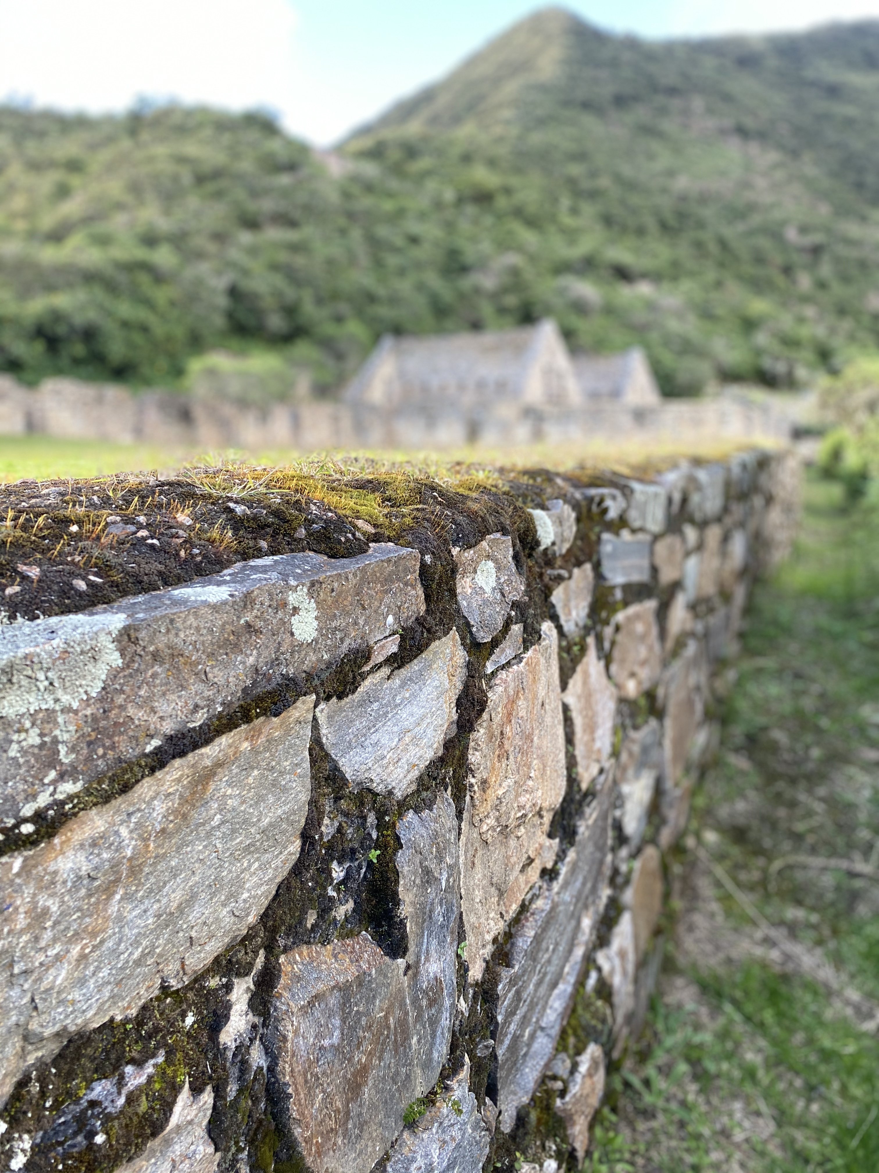
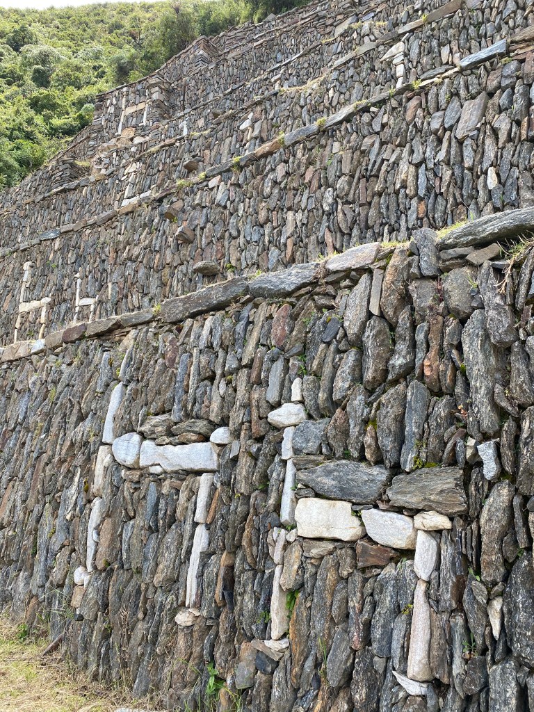
Exploring Choque is not restful. It’s a few hundred meters higher than the campsite and other than the Plaza, exploring the different sections requires steep climbs and descents. The famous llama terraces require such a descent, emerging through the jungle to these incredible rock walls – each taller than a person – adorned with white llamas. I felt very fortunate that Jack, a structural engineer, was there to explain some of the features such as the vertical rocks allowing for drainage.

It was quite magical experiencing the place at a point in time, knowing that it is likely to change over the next decade or two. More will be uncovered. The government’s been threatening a cable car to it from across the valley. My prediction is that a cable car won’t be necessary when there a human-carrying drones that can achieve the same.

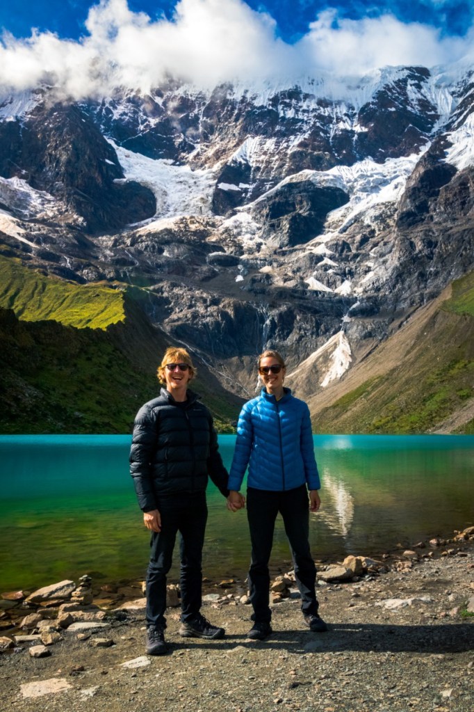
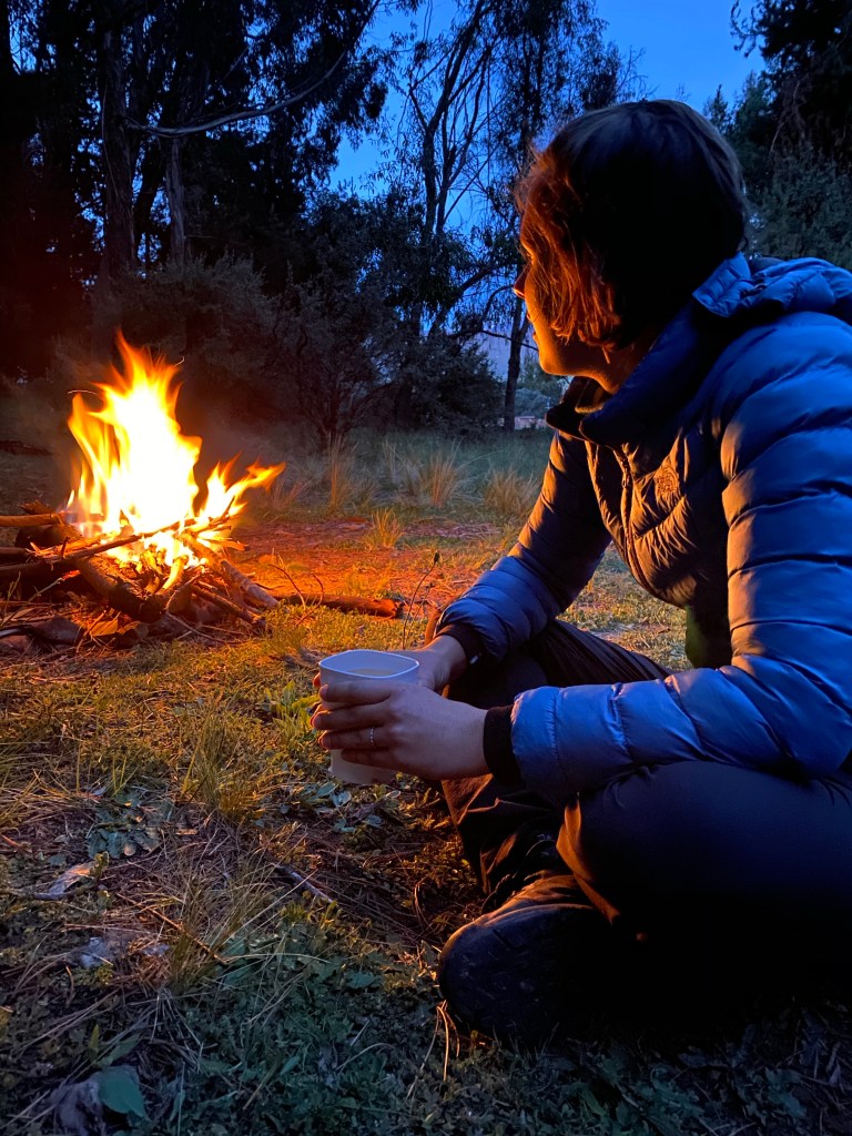
Our final night was spent at Capuliyoc eating seriously delicious stir fry (‘saltado’) and Heather and Jack taught us Yaniv, a card game, then joined us for some 500. The clouds swirled around and sometimes exposed the snow-covered peaks of the mountains opposite.

I’m so grateful to Dan for pushing ahead with this trek despite my concerns – which were largely attributable to having had a cold for about a week which I was sick (pun intended) of and I took to blaming the altitude for its persistence. I’m so glad we persisted with the trek.

We’re now heading back to Cusco, with a much more relaxed driver, where we’ll spend a few days before heading to Paracas (can you hear the people sing? I’m beside myself). But before then: a few more delicious coffees and Green Falafel wraps to enjoy. And a proper shower.

VRPS

[En route to Cusco]

In search of some humanity

Cusco is delightful – with all the splendour of a church-filled European city with the spiciness of Latin American culture. The old town is a web of narrow cobblestone roads threading between beautifully preserved architecture. And every few metres there is someone to target you, a gringo, to offer you a tourist transport deal or to encourage you to come to your restaurant. It’s incessant. You just need to keep your eyes up on the golden light of the lamps and enjoy the ambience.

It was under these golden lights in the main square two nights ago that our good friend Alex, who after our Atacama trip together we’ve run into in Potosí and Sucre, spotted us and joined us. It was so lovely to see him again – and also says something about how most travellers follow the same route.

On Saturday, we joined a walking tour and otherwise explored the winding streets of the old town. We found a talented barista, a delicious falafel joint, joined a yoga class and vegan dinner, and found a few bars with salsa music for a dance. One of my favourite moments – and this sounds so small – was enjoying the light through the flowers at the table of a cafe.

There is Incan stonework throughout the city, but this 12 sided piece is particularly awe-inspiring.
This is one of three 16th century churches in the main plaza.

Yesterday, we joined Alex and his two Argentinian friends for a mission out to Laguna Huamantay (it looks like ‘humanity but it’s pronounced ‘wah-mun-thai’). We hired a car together, and set out on the three-and-a-half hour drive to the start of the walk. It was a stunning drive along a huge valley, set to Dan’s excellent soundtrack featuring heavily Ziggy Alberts and Calle 33.

After the long drive, we set off on a sustained uphill climb to the lake. When we arrived, the encircling mountains were largely shrouded by clouds, but after a brief but heavy (and also freezing and a bit miserable) downpour, the sky opened up to the most incredible view of blinding white snow over the bright blue-green of the lake, with its dusty honey-coloured shores.

🙏 @alexandrymizoni
🙏 @alexandrymizoni

We spent hours up there, and it was quite late by the time we started the long drive home – this time to Alex’s impressive playlist of Spanish and Portuguese songs as we attempted to sleep while the car jolted us across the sharp gravel.

We’ve extended our pre-trek stay by another day so we can enjoy a Sunday exploring the Incan ruins near the city and get ready for what will hopefully be a super challenging and rewarding trek to and from the Choquequirao archeological site.

VRPS

[Cusco]

From one chapter to the next

I asked Dan how he’d sum up Bolivia in five words. He answered:

  • Hats (the ones worn by cholitas)
  • Mountains
  • Altitude
  • Coca
  • Politics

It’s a concise summary, which I agree with whole-heartedly. I can’t believe how the thirty days since we started the Salar de Uyuni tour have flown. It’s been thirty days of breathing (and getting out of breath) at altitude, thirty days of cold, despite the fact that it’s summer. (Can you tell I’m getting excited for our sea-level beach time in Paracas? Imagine the joy of wearing shorts…)

Bolivia is poor in wealth, but rich in culture. Its indigenous peoples flourish in the practice of their traditions. It’s a joy to see women in their traditional wear, even in the cities. It’s incredible to see the ferocity and joy with which they celebrate their culture through Carnaval.

Bolivia is a place of sprawling markets, and saleswomen to whom you are expected to remain loyal. There’s something delightful about going to the avocado-only seller, who will give you a taste of how good her avocados are, and then will select for you the right avocados ripe for eating ‘hoy’ (today) or ‘mañana’ (tomorrow).

Bolivia is a country of hard work over long lives. As an Australian, there was something confronting about seeing elderly Bolivians who should have been enjoying retirement working the land, running shops, or begging.

It’s political situation is precarious and everyone is anxious about whether the May elections will make things worse. Numerous parts of the economy have already been hit by reduced tourism due to political unrest and high visa fees for Americans and Israelis. While there are tourists visible in all major cities, it feels like a country for Bolivians what accommodates visitors, not a country for the visitors.

And, of course, it is a country of exceptional natural beauty, which comes with a degree of hostility for living and transport. It is amazing the life that thrives at altitude in the Altiplano – including the llamas and the flamingos. It is also amazing that they’ve managed to build roads winding around steep, relentlessly wavy valleys and mountains.

And for me, one of the highlights was undoubtedly my Spanish lessons with Nelson. They’ve put me on a path that I’ve managed to continue following in the weeks since finishing formal classes, and will hopefully continue following for the rest of my life.

We’re now in Peru.

We spent yesterday morning tracing the edge of the enormous Lake Titicaca to Puno, and we’re now en route to Cuzco. (Every time I think or say the name of the city, it’s to the tune of the theme song to the Emperor’s New Groove. If it’s stuck in your head too, now, you’re welcome.) The time around Lake Titicaca has actually been really lovely, albeit brief. The towns around it seem to have this beautiful peace that comes from being near such an elegant body of water. They also serve lots of delicious trout.

This bus trip to Cuzco, while long, is a bit of a treat as we get to enjoy views of rolling green hills and farmland from our ‘panoramic’ seats at the front of the top level of the bus.

VRPS

[En route to Cuzco]

Being reminded of home

There were lots of small things on our Peñas trip that reminded me of home. I wasn’t expecting it, as Peñas is a very small town not particularly close to anywhere. All I was expecting as good rock climbing crags (which it had). It also had:

  • Gum trees
  • A similar colour palette to Australia’s Parliament – with gum leaf pink in the rocks and gum leaf green in the grasses
  • Rock that felt similar to Pages Pinnacle

But there was also plenty to remind us that we were in Bolivia – free-for-all camping, all except one tiny shop closed, and every single person we came across giving us a greeting (‘buenos días’, ‘buenas tardes’).

We set off with Robert and an enormous amount of gear on Monday morning, losing our breath while walking a few blocks (everything was so heavy!) and squeezing onto the teleférico so we could take the bus from El Alto.

Just quickly – let me introduce Robert properly. He’s a German man who has lived in Bolivia for the last thirty years and knows all the climbs and the peaks like the back of his hand. He’s a bit over 60, but climbs as if he’s 25. He’s summitted most (all?) of the 5000m+ mountains in Bolivia, and has discovered a number of new climbing routes.

Going back to the bus, which is a story unto itself. We were the last three to get seats so we were left with those at the back – sitting higher than the rest of the bus with the ceiling half-caved-in above (that’s an exaggeration, but there was a dent). I couldn’t sit up straight – there wasn’t enough room. The thing that makes this deal so raw is that we are noticeably taller than most Bolivians, and certainly all of the ones sitting in the lower comfort seats (save maybe two cholitas with their top hats worn high). Fortunately, Dan snagged a front seat. I just hunched perilously close to the woman in front of me.

The ride wasn’t too long, and we leapt our at the Peñas school and walked just a few minutes to a clearing with rocks on one side and firs and gum trees on the other. We set up camp and, after lunch, set out for the rocks.

It’s hard to describe Peñas, but I’ll try. It sits in the shadow of these large hills (when can you call it a mountain?) covered in volcanic rock. It’s eclectically strewn across the grassy slopes, and when I first saw it, I didn’t think the angles were right for climbing. Turns out you just need to know the right spots. From the hills facing east, you see this enormous expanse of green farmland with villages here and there, ending with the magnificent Cordillera Real mountain range on the horizon.

All afternoon, we set up and tried different 5 and 6-grade routes near to our campsite. The rock was super grippy and heaps of fun to climb. Highlights include Dan’s phenomenal ascent of Torres Teresa – you can see him there in the left crook of the rock. Lowlights include Dan accidentally putting his hand on a cactus while moving between routes.

If you squint, you might be able to see me climbing in the background.

My husband, the Lord of the Flames, whipped up an amazing fire for the evening and we all had an early, and freezing cold, night.

We got up early to make the long walk to a multi-pitch climb that Robert had been spruiking since he met us. We were fortunate that the early morning clouds lifted. It was quite a climb to the beginning of the route – a 120 metre ascent over four pitches (but we did the first two together). Skip this if you already know: a ‘pitch’ is a section of climbing where a person can belay from the top of the second. Multi-pitches are generally too high to be belayed in one go from the base because ropes are generally only 60 metres.

It was our first multi-pitch, and I have no doubt that the pressure of ‘we’ll all have to go down if one of us can’t finish a pitch’ was what made me get up a route that I still maintain was beyond my ability level. Some sections were enormous fun. Others felt like you were finding foot and hand holds where they didn’t really exist.

This really doesn’t capture just how far up both of us are at this point.
Last handhold of the 120 meter climb. If I wasn’t so exhausted, I’d look even more exuberant.

But we made it. We topped off this challenging climb with a challenging two-hour hike back to camp over all the ridges and peaks of the hill (mountain?). We were even treated to a view of Lake Titicaca!

Lake Titicaca to the left, Cordillera Real to the right.

We parted ways with Robert to head on to Copacabana for the evening. Three minibuses and a back of the ute later and we’ve made it to this peaceful city. The back of the ute was both a highlight and a life-saver, as we’d watched too many full buses pass us.

While I’m excited for our next adventures and maybe some more climbing in Colombia, these last two days have made me ache for our own climbing gear and Kangaroo Point and the other crags within day-trip distance of Brisbane. Something to look forward to when we return!

VRPS

[Copacabana]

Less squeezy days

This year isn’t just about rushing around trying to squeeze the most out of every day. Sure, we hope to be squeezing more days than not, but it’s also really lovely to enjoy some quiet slowness.

Our last two days in La Paz have been just that. We have partaken in some absolutely delicious meals – notably a breakfast and lunch (on separate days) at Higher Ground and steak for dinner at Casa Argentina.

We’ve enjoyed extended time reading, studying (me), playing ukelele and chess (Dan) and napping. We’ve motored around the teleférico network to enjoy a night view of the Mirador and we joined the hoards at El Alto’s Sunday market for as long as we could bear (which wasn’t long).

I’m now getting my teeth stuck into Harry Potter in Spanish and I’m loving it. I’m incredibly slow, and probably look silly set up with my phone as a language dictionary as well as a notebook where I write down translations, but I can feel myself developing just un pocito of momentum and it’s exciting.

We’re ready to move along. Tomorrow we set out for Peñas with our climbing guide, Robert, for two days of rock climbing before we hot-foot it out of Bolivia and into Peru. You can expect from me soon a sentimental reflection about what makes Bolivia Bolivia and what we’ll miss about it.

VRPS

[La Paz]

So Inca-redible

Dan came up with the title. Don’t blame me.

And while the walk was magical in unexpected ways, at least for the first day I wasn’t sure it was ‘incredible’ in the classic sense. We were promised incredible views of towering mountains and sweeping valleys and instead, after an unexpected and very slow 600m ascent to the pass at 4,700m above sea level, we were gifted with clouds all day. Not up-in-the-sky clouds. We were in the clouds, surrounded by not-yet-raindrops wetness and unable to see beyond 20 meters in any direction.

There are costs and benefits. Maybe the costs outweigh the benefits. We were deprived of amazing views, but we did get to experience a world full of edges because everything came to an abrupt stop before a wall of white. It’s all rather mystical, because you don’t know what’s in store beyond a few meters ahead.

It was a quiet day – the only humans we saw were two farmers and even the village of Takesi seemed empty. But my favourite part was the streams and rivers. This area experiences the wet season in a way Australia doesn’t – it gets predicably and very rainy and the river swells and takes out half of the bridges each season. We were fortunate to avoid heavy rain, but we did get to enjoy the crystal clear waters of the streams and creeks. Nothing like La Paz’s extremely toxic, extremely brown (more so than the Brisbane River), putrid river.

And – before I continue – I should explain the title. The Takesi trek is a trail laid by the Incas (in the same style as the one to Maragua near Sucre). Some sections are wide and beautifully laid, but most are overgrown and muddy, with streams running through them.

Anyway, this is the view we set up camp to.

And this is the view we woke up to.

The second day of the trek was significantly more rewarding, with most of the day spent with clear views. It was only in the chilly morning that the clouds both ascended and descended on us, like the compactor from Star Wars IV, for a few hours of white, edgy walking.

For most of the day we were able to see the giant valleys we were traversing, and could spot our path ahead. It was an extraordinary, but extremely long, walk. I met Dan the Passionate Botanist for the first time, who skilfully took pictures of all the different bright wildflowers. The ones below are the tip of the iceberg of his digital bouquet.

Today featured descent into the lush, humid, hot and dense rainforest, and wild river crossings. Two of our three major crossings had lost their bridges sometime earlier in the rainy season, so we were left to find a section that could be safely rock-hopped. On our second crossing, we had to carefully wade through quasi-rapids. Dan made it look as easy as making a bed. I, on the other hand, was full of adrenaline.

We have made it to Yanacachi, where we’ve pitched our tent on the overgrown football pitch, still under the watchful gaze of the mountains. Here’s to going to sleep sore, and no doubt waking up even more so…

VRPS

[Yanacachi]

Feeling alive on Death Road

I’m a little bit in love with La Paz. This city sprawls through a basin ringed by the higher ground of El Alto, and it’s houses are fashioned around the lines of rock that still run through the city.

It’s noticeably more wealthy than the other Bolivian cities we’ve visited. There’s a thriving coffee and food scene (though more pricey than elsewhere), and some high rises and apartment blocks. Long teleféricos connect lower and higher grounds, and to me, give the feeling that this place is permanently celebrating (cable cars remind me of the Ekka) – which isn’t entirely untrue as it’s now Tuesday and this country is still celebrating Carnaval with fire crackers and foam fights and raucousness in the streets in the wee hours. Have we had enough yet?

Dan’s decades of investment in his cricketing skills has equipped him with the ability to catch these kids’ waterbombs and throwing it back at them when they have nowhere to hide…

Yesterday we got straight to it and joined a Death Road mountain biking tour. Death Road – the connection between La Cumbre at 4,700 m to Coroico and the start of the Amazon at 1,200 m – is no longer as dangerous as it once was, as a bypass has been built around the bulk of the narrow track (which once would see cars and buses pitched off the edge as they attempted to pass). It also means that today’s cyclists enjoy relative peace as the road is generally used only by them and support vehicles.

There’s no better demonstration of this than this picture of dust-covered Dan doing the same route with his brother fourteen years ago (pre-bypass). He recalls chaos – buses passing him as he flew downhill and trucks reversing so traffic could negotiate tight corners.

Nowadays, you’re kitted our with the works: jackets and pants, a full-face helmet, shin and elbow guards, and gloves.

The ride takes you through stunning landscape. At the start, the weather was bright and the landscape glistening. Soon, we descended into thick clouds which obscured a lot of the view for a few hours, before emerging into more sunny landscape. The road is carved into the side of a mountain and the valley views are spectacular.

The ride is 55 km, and despite being all downhill, utterly draining. After the too-brief paved section at the top, the remainder is rocky and bumpy. We were in a group of absolute riding superstars, and I brought up the rear the entire day by a substantial margin. I swear the rest of them (Dan included) didn’t use – or didn’t need to use – breaks. Yours truly prefers a degree of control and caution.

Our plan is to stick around La Paz for a few days and do a nearby hike before setting off for Peru. I’m excited that we’ve picked up a beautiful ukelele so Dan can embark on a music journey while I continue on my Spanish journey. He’s currently providing background music while I write this.

I’ll augment this post with more photos when we receive the guide’s. In the meantime, count yourself blessed if no one is going to foam you in the face today.

VRPS

[La Paz]

So many rainbows 🌈

I know it’s only thirteen hours since I last wrote, but you see, so much has happened, and my dear husband (and maybe this blog’s biggest fan) has dropped numerous hints that I should write tonight.

Today has been filled with with the exuberant celebrations of the Altiplano communities. Their parade through the streets of Oruro lasted, we estimate, 14 hours, and the majority of that was in the rain. We were fortunate that for the last few hours everyone took off their ponchos so we could enjoy the vibrant colours of their traditional wear.

I’ll let Dan’s photos do the talking:

It’s quinoa! Everyone in the parade had local plants in their scarves slung around their backs.

In the afternoon, we followed the sound of electro music to a crowded university full of seriously drunk students. We stayed long enough to befriend and dance with some first year law students and then quietly left them to it. We then went to the end of the parade where we found a lot of seriously drunk paraders. We joined some empassioned Orinocans who told us many, many times that Evo Morales (former president) was from their community.

Don’t get me wrong – not everyone in this city is totally plastered. Just most of them. But not these adorable … I think they are alpacas?

VRPS, with credit to DPS for the title emoji

[Oruro]

Anticipation in Oruro

We were woken at eight this morning by the sounds of flutes and drums and whistles, even though it’s raining outside. For the last hour and a half, there’s been no pause. I think when we poke our heads out the door, we’ll find each of the Antiplano communities parading around the streets in their matching traditional dress.

While the average tourist gets out of breath at almost 4000 metres just walking around, these impressive locals (in a broad sense – the Altiplano is an enormous area) don’t seem affected as they walk, carry heavy drums, and play wind instruments.

We arrived in Oruro at the cruel hour of 5 am after a near-sleepless overnight bus trip from Sucre. The bus was fine, but the rocky surface and wild corners all night were not conducive to proper sleep.

Oruro is a different city. It doesn’t have the colonial architecture of Sucre and despite the coloured roofs, feels like dusty desert city. Even Spanish is not broadly spoken, and I understand that there are a number of different local languages thriving here.

We took yesterday gently as we were exhausted. We strolled around the markets overflowing with celebratory materials like foam guns and confetti. We visited the Anthropology Museum with our hostel guide who (with clear and slightly slower) Spanish described the local historical artefacts from the region, including carved stone animals, mummified bodies, textiles and traditional Carnaval masks from the last 80 years.

We took the new, shiny teleférico up to the statue of the Virgin which overlooks the city and basked in the splendid views and the sounds of Carnaval celebrations.

It’s been fun arriving before the main event – the enormous Saturday parade – to see this city setting up and getting excited for the celebrations.

A work in progress.

We’re now well-rested, and ready to go join the talented musicians whose energy can’t be stopped by this pouring rain.

VRPS

[Oruro]

Bird song, thunder and Pachamama’s fingerpainting

We found the funniest mistranslation of our trip so far at the entrance to a six hundred year old Inca trail through the mountains outside Sucre. In English, it informed us that the locals would use the trail to transport goods “in flames” (a little uncouth!) but in Spanish it clarified that it was actually transport “en llamas” (exactly what you think – by llamas). In the writer’s defence, flame is a correct interpretation of “llama”, just not in this context.

We expected the morning getting to our trek would be quiet and uneventful. We left the house to find the streets closed off and people slowly preparing for a big Carnaval parade. We waited a few hours and I was glad we did, because the parade was lovely. The audience was given wax-sealed eggs, chocolates and candies but beautifully costumed performers and music school after music school presented their dancers and their enthusiastic musicians.

It’s near impossible to pick a smaller set of Dan’s photos to share, so here’s more than a couple:

Just after midday, we took our extremely broken seats in a squashed, rattly minivan which would drop us at Chataquilla. The bus slowly wound its way up the mountains behind Sucre. At Chataquilla – a top-of-the-mountain sacred site with a church and a little amphitheatre – we started the Inca trail down.

The trail was surprisingly wide for such a steep section of mountain, made by placed flat rocks. We were blessed by spectacular clear views, including of a storm in the distance with its rumbly thunder. The descent was never ridiculously steep, but over two hours of downhill trekking exhausted us.

We stayed overnight in the only two spare beds in the small hostel in Chaunaca, as a tour group of eight already had the rest. When we went to buy provisions, we also discovered that the same group had bought up all the available bottled water in the town, so we made ours stretch (without much difficulty).

What’s the feel of Chaunaca and surrounds? Surprisingly green and lush for an area whose dry orange and red rocks remind you of a desert. It’s a tiny town in the crook of a bunch of different hills and mountains. The shopkeepers of the two little shops in town are both elderly – one over one hundred years old – and still happy to serve.

The younger of the two shopkeepers in Chaunaca

This whole trek kind of unfolded as we went. We knew that there were lots of different towns along the way but maybe didn’t appreciate how small they’d be. In the morning, we opted to take transport to the Maragua crater so we could focus our energies on the trek from there to Potolo.

The transport we ended up taking was the school bus, that for almost an hour rattled around the sides of mountains. The uneven dusty ground made Jesus and the llama swing wildly under the decorations adorning the front of the bus, while the kids looked utterly unfazed by this part of their morning routine.

Maragua was even better than I imagined from Google maps. It’s like someone gave Pachamama (Mother Earth) a canvas of green fields and she drew heaps of parallel wavy lines all through it – sandy yellows, sandy pinks and light browns – so many waves encircling the crater. The fields were a jubilant green and the sky peaking through the clouds a rich blue.

At Maragua, we visited the Garganta del Diablo (Devil’s Throat) waterfall and spent some time there in a cool wet cave and with a cup of tea musing about language learning. We had an early lunch back in town and set off to the edge of the crater for Potolo.

The walk to Potolo was stuffed full of rewards, but was also truly exhausting. Beyond the crater, we were greeted by farming lands streaked with smoky mauve and dusty maroon coloured soils, which gave off the impression of a rainbow when mixed with the usual grassy and rocky colours. Another range looked like the wavy sizes of the craters, but this time in dark pink, as if it were permanently lit by a rich sunset.

These colours were so much richer in real life

We tried to find the dinosaur footprints but the area was very poorly signed and we didn’t have enormous amounts of excess energy saved for getting lost.

We crossed valley after valley, chatting to locals when we could (if they spoke Spanish; most speak Quechua), meeting their flocks of sheep and goats and either having dogs aggressively bark at us, or follow us for a few kilometres. The whole time, the scenery was breathtaking.

We skipped the last few kilometres into Potolo as a taxi passing by (our first car passing by all day) with two existing passengers agreed to take us back to Sucre for an eye-wateringly small amount of money. Even in the coca-scented cab, the views were a treat – especially tracing the edge of a ginormous gorge.

These two sun-baked cookies (we used plenty of sunscreen, I promise) are going to sleep well tonight.

VRPS

[Sucre]